Sunday, March 15, 2009

Grand Canyon Skywalk!

Dear Friends and Family:

Last week we went to Las Vegas for the Mountain West Conference's basketball tournaments. They both ended poorly for the UNM men's and women's teams, so the less said about that the better.

The scenic highlight was a trip I took Thursday to the Grand Canyon Skywalk. (At the official Skywalk website, my computer warns: This site may harm your computer, so rather than risk that, I've linked to the Wikipedia site.) Here's a picture.


The Skywalk, which opened just two years ago, is a horseshoe-shaped platform that juts 70 ft. out from the canyon edge. The platform walkway is plexiglass -they make you wear booties to protect it - so you can see straight down. It's about 2000 ft. down to the next ledge; nearly 4000 ft. down to the level of the Colorado River, which you can see in the background, lower right.


Skywalk is on the Hualipai Indian Reservation, west of the main part of the Grand Canyon National Park, just before the river becomes Lake Mead. From Vegas it's about a 120 mile drive, with 14 miles unpaved and fairly slow going (20-30 mph). The Visitor Center, on the left above, which sits on top of the bolts that hold the platform to the rocks, is still under construction, but rest assured you can still buy the T-shirt that proves you've been there.

Here's some more pictures:

Go Lobos!


Here's a poorly aimed self-portrait. Need a longer arm.

I actually got more of a queasy feeling standing close to an unprotected sheer dropoff than in the safe confines of the glass-bottomed platform. At the ledge a loud tourist was indignantly asking a Hualapai host, "How many people have fallen off here and died?" The answer was none, but the tourist was pressing his luck.


In case you're wondering, where's Susie? Susie doesn't do unprotected ledges. Driving 2.5 hrs. to find one is not her cuppatea either. We visited Grand Canyon several years ago and she sat on the ground about 50 yards back from the edge calling to the rest of us, "Don't go any closer!" So she had a restful day back at Heidi's.


The place seems a little pricey, though its uniqueness and the surroundings are what you could call priceless. You pay $40 for a bus that takes you from the parking lot to the Skywalk site and one other view-point, but when you get to Skywalk you pay another $25 to actually walk out on it. That was a surprise. Also, you cannot take cell phones or cameras onto the platform. There are, of course, photographers out there waiting for you so you can get a professional picture for $30. I was in a picture with a Hualapai chief and four Japanese young women, so I chose the T-shirt instead for my souvenir.


The road out from Las Vegas takes you across Hoover Dam, so I stopped on the way out to look around.


For the last several years, when we've driven Tuzigoot out Vegas way, we've had to detour around Hoover Dam, by way of Laughlin, because of the congestion caused by trucks and motor homes on the narrow and winding dam approach and crossing and because of construction of a new bridge across the Colorado canyon at this location. In the next picture you can see the two legs of the supporting arch reaching out toward each other. Friend Mike Blackledge, who drove this route a year ago and again this year for the tournament, says that there has not been much visible progress on extending the arch-legs the past year.


On the way home I snapped this closer view as I drove by.


I can hardly wait to drive Tuzigoot across this bridge when it's done.


One more scenic aspect of the drive to Skywalk is a nice stand of Joshua trees, plus sky and mesas.


Back in town Th. evening, we had dinner with Heidi at the Bellagio and greatly enjoyed the Bellagio Conservatory's spring display.


Then it was out to the arena to see the Lobo men lose a heartbreaker. Thanks to Heidi's connections, though, we watched from the comfort of a suite and it happened that that six overtime Syracuse-Connecticut game was concluding at that time and we watched that on TV when we had to avert our eyes from what was happening on the floor. The next day, at noon, the Lobo women lost a heart-extracting game at the very end, so we were outa there, catching an evening flight home.


Just to get my hoops injection, March Madness high-school style, I spent Saturday at the state basketball tournament -- five games worth. Lots of fun.


Cheers,


Susie and Rob

Thursday, January 29, 2009

Westward Ho - 3 - HOME

When I check the TV on Monday morning (1/26), at our Elk City campground, the weather forecast map is showing ice over the whole state of OK, extending west into the TX panhandle. Previous maps had made it look like the panhandle would be west of the ice problems. Time to get moving.


We close up and head west ASAP. Not far into TX, after not much more than an hour of driving, we encounter fog. It’s a misty fog that freezes on the windshield. Quickly. Becomes more of a drizzle. Wipers, defroster, and de-icing fluid aren’t enough to keep Tuzi’s big front windshield clear. Particularly troublesome is ice that blocks my view of the rearview mirrors. We plug in our electric space heaters and hold them up to the windshield. We drive exit to exit for a while, stopping at each to scrape and melt ice. Finally, at the Alanreed exit, where there is a general store, liquor store, deli (they sell packaged sandwiches), motel, filling station, Route 66 gift shop, and post office, all collocated and all belonging, it appears, to the same owner – anyhow, for any of those services you pay the same nice lady – we decide to stop for the duration. (Alanreed’s motto is: See Alanreed, all from one spot. I should have asked if Alan is home.) I hadn't realized there was a campground when I pulled in. Primarily, I was just going to buy some de-icing fluid. The word from Amarillo, 60 miles down the road, from the nice lady in the Alanreed general store, our Amarillo friends - the Sooters - and travelers from that direction, is that the fog is thick and roads are getting icy.


I ask, Do you have a campground? Nice lady says Yes, we do! (my exclamation point). We’re in no hurry and there’s no reason to take risks, so we pull into the campground (maybe five sites) and hook up. We’ve got a 3/4 full propane tank, 50 amps of power, and satellite TV to keep us warm and entertained.


Because of the continuing freezing drizzle we decide not to open the slide-outs. If ice built up on the awnings that extend over the slide-outs, that could be a problem and if ice got into the mechanisms, we might not be able to close the slide-outs until the spring thaw. Also, there’s less space to heat with the slide-outs closed. We’ve each got our own space. I’ve got the front TV and reclining chair. Susie’s got the back TV and bed. We’ve each got space heaters that we can conveniently aim and thus not use the furnaces to heat the whole interior space.


Late in the afternoon another motor home pulls into the campground. The driver hoped to get to Indianapolis by Thursday to do some work (work ?) there. But between Amarillo and here he saw an overturned semi and decided that was enough. On the Weather Channel most of the ice-storm attention is focused on further east, so things are definitely not going to get better for him as he goes.


Tuesday. It’s still cold (11 in Amarillo) and apparently icy, though semis are rolling at moderate speed on I-40. No other traffic that I can see, though. Tuzi’s got a nice coating of ice on the windward side. Roy Sooter calls from Amarillo and says the word there is don’t drive if it’s not necessary. Also, when I walk over to get a newspaper, the parking lot is ice-coated. So, we sit another day. Hoped it might clear up by mid-day, but it didn’t. So, we’ll spend Tuesday bundled up here. By evening, though, there is a little sunshine and a nice sunset. Forecast is promising for tomorrow. We’ve got enough propane for another night, so no problem. Getting a little low on water, but the only way to get more water into our tank is to move to another slot, with a still-functioning spigot. That’s too much trouble and we’ll be OK if we skip the showers, I fearlessly claim, so we stay put.


So, too, is our Indy-bound neighbor. I visited him briefly and he said his furnace quit during the night. He was up around 5 am working on that. While the furnace was out his water lines froze somewhere, so they were without water and he was trying to find the right place to apply some heat. Of course, we can buy drinking and toothbrushing water from the general store, or, if worse comes to worse, rent a motel room if our motorhome systems don’t work. They and I (not Susie, though – she has her standards) can also use the general store’s bathrooms, so I don’t offer them a share of our dwindling water.


It's good we stopped where we did, and fortuitous. I don't think there are any RV parks in the 60 miles from Alanreed to Amarillo. There is a nice visitors center not far down the road and we probably could have done a day there using power from our diesel generator, but we wouldn't have had a walk-to grocery and gift shop.


When I went up to the Alanreed command post for some provisioning, I browsed a Route 66 guidebook. There were a couple of pages on Alanreed and I learn that the nice lady in charge is named Dixie Crockett. I take it that Route 66 afficionados know her or know of her. I buy a postcard and she autographs it.


Here is an Alanreed picture from the above link:


I remember stopping here once on a previous Tuzitrip to get gas. The price was outrageous and the driveway out of the station was a mess - potholes, broken pavement. Vowed never again, but conditions change. Now the station's price display, where all travelers can see it, shows last summer's prices - $3 plus for gas, $4 plus for diesel. The pumps, though, show current prices.


By the end of Tuesday, we’re both getting a case of cabin fever, as Susie says, the fidgets. I’ve run out of books to read. I’ve played a lot of Palmpilot Scrabble and solitaire. I write up our days here for eventual posting. I know I should/could be working on my class notes or textbook, but can’t get motivated. Susie reads and watches TV. Every once in a while when we turn too many electrical things on, I have to go outside and reset the breaker. We’re on 50 amps, but still cross that threshold occasionally.


The day’s saddest words: No wireless networks within range.


Here's the Texas panhandle scene:


Wednesday. Sunshine!


We bid farewell to Alanreed and Miss Dixie. I-40 has been sanded and it's clear. We head for home - 340 miles. When you're within a day of home, it's hard to resist. After Amarillo there's no sign of previous ice. We've dropped our plans to go by Corona, NM, to see Susie's brother. Charlie and Sue are in Albuquerque this day. You may recall, you persistent readers, that we started this trip by dropping plans to go by Corona. Also, more deja vu, in NM we encounter a strong crosswind from the north, as on Day One, but not so fierce. We stop in Tucumcari for a pig-out lunch at the Flying J's Country Market buffet (New Year's resolutions kick in tomorrow). The weather's much warmer there than where we've come from. We've been shedding ice from Tuzi all along the way.


Here's the traditional almost home picture through the windshield:


Between Cline's Corners and Moriarty (say 40 miles from home) a semi pulls alongside and the driver gestures, pointing down, I think. Oh, No! What could be wrong? More deja vu. I pull over and check tires, Tuzi, even on top, and the Explorer. Can't find anything dangling or damaged. A couple of basement compartment doors are not latched. They can't really swing open, but I suppose wind gusts could cause them to lift and fall occasionally. However, it's unlikely anything could fall out. Nothing is missing. The doors were probably frozen in the morning when I made my pre-departure check. Anyhow, we proceed and nobody else has any issues with us. We get home around 3:30, unload just the essentials, and make ourselves at HOME.


It's been a great trip, even with the problems we encountered. Susie gets teary just thinking about the family cruise. A very special time for all of us. Odometer says Tuzi covered 4700 miles.


Cheers,


Susie and Rob

Saturday, January 24, 2009

Westward Ho - 2

Friday, 1/23. From Counce, TN, which is 10-15 miles south of US64, we opted to let Miss Magellan lead us to Memphis by the quickest route. Thus, we first took a state highway that winds south into Mississippi. This also happened to be the route used by trucks hauling logs to the PCA paper plant. Besides meeting a dozen or so trucks in as many miles, I had an empty one behind me, eager, I'm sure, to go pick up his next load. No place to pull over and at every intersection where our paths could have diverged, they didn't. But, I was doing close to the speed limit, so didn't feel I was impeding his legal progress. Fortunately, it wasn't long until we were on a divided highway straight into Memphis. Got through that city and across the Mississippi River with minimum stress. Almost always, other drivers are helpful when I suddenly discover we need to change lanes.

Hard to get pictures of rivers and bridges when you're driving, so here's one from the internet.

I found some other good daytime pictures at this website, but couldn't copy them.


Still eschewing interstates, we caught up with US 64 crossing Arkansas. It runs straight west on a route that runs north of I-40, bypasses Little Rock, then becomes intertwined with I-40 at Conway, NW of Little Rock. From past experience, I know I-40 in eastern AR has rough pavement (or construction) and lots of semis. Anyhow, them's the reasons for taking 64. Found it to be generally 2-laned, but with frequent passing lanes. Also, paved shoulders, good pavement, and optional loops around most of the towns along the route. And it's flat - Mississippi River Bottom Delta Land. Not much traffic except for Wal-Mart trucks coming from somewhere. All of which makes for more serene driving.


Anyhow, while driving in a slow-traffic lane at one point, I saw the flashing light of a vehicle leading two wide-load trucks hauling modular houses coming up to pass me. I pulled further to the right and slowed down because we were approaching the end of the passing lane. The houses passed, followed closely by two semis. By the time these all passed, we were essentially standing still at the end of the passing lane. All of a sudden we saw the semis making emergency stops, smoke rising from skidding tires. Well, there was a bridge just past this three-lane section and apparently the house-haulers suddenly braked because of oncoming traffic on the bridge and that caught the semis by surprise. Fortunately, no collision (Semi Hits House on Bridge was the headline I could see).


At Conway, to save time we got back on I-40 and stuck with it for a while until the pavement went bad, so it was back to US 64. At this point both roads are following the scenic Arkansas River valley. Late afternoon, so we eventually got back on I-40 and got to a campground in Van Buren, just three miles from the OK border. Eight hours on the road today, longest since we left Jordan Lake. Up next: family weekend in OK.


We've driven I-40 across eastern OK several times in recent years, often in a motor home and it is so rough (worse than Arkansas!) that I have repeatedly composed letters in my head to the Governor, but never got them on paper and in the mail. Want to tell him to put a billboard up at key points, with his face, telling travelers: "I sincerely apologize for the condition of Eisenhower's magnificent interstate highway system in our great state and promise to fix it quickly." Now I wondered if the Obama stimulus package would expedite the work. After we got to Edmond, I saw a newspaper article that said OK was in for $544 million in highway funds. Now my letter will ask that it be spent on I-40.


Also, while driving, I composed this jingle for the governor to put up:


Pardon our bumps
The economy is in the dump.
Spend more of your money
and we will make this road
Smooth as honey

Burma-Shave


Anyhow, the road was fine at the border, but soon deteriorated. Just beats you like a drum. Then, hopeful sign for future trips, there was a stretch of 10 miles or so where new pavement was being put down. After that, another stretch badly needing new pavement led me to opt off at the first available exit. The big treat there was diesel fuel at less than $2.00! (But that got me to speculating that the reason for the low price was probably because OK, an oil-producing state, doesn't tax the oil companies (and consequently drivers) as much as other states do, so consequently the state has less funds for road repair and maintenance. More taxes! Better roads!) Had about an hour's interlude on pleasant backroads, then back on I-40 for the rest of the way into OK City (and the pavement improves the closer you get to the city).


Got to OKC in early afternoon and checked in to the Twin Fountains RV Park, a nice place at the intersection of I-35 and I-44 in NW OKC. Has everything but a RR track. Plan to stay here two nights and leave Monday. Went to see my Mom and then to sister, Connie's, for dinner and visiting.


Cold weather in OK. Susie says OK is the coldest place she's ever been and also the hottest place she's ever been. I suggest we take a side trip to see son Jeff and Valerie Hinkle in Aberdeen, SD. We've been getting frequent reports from them: lots of snow, temperatures in the -30 degree ballpark (and that's too cold for playing ball). Think Fargo. No, thanks, she says.


You would think that after our NC experience we would be closely watching weather forecasts. You would be wrong. My sister, Verla, also at Connie's, said, Did you know we're supposed to get freezing rain Monday? Uh, nope. We watched the TV weathermen closely that night and it was "deja vu all over again." Ice storm coming! Hazardous driving, downed power lines, and other mayhem on the way! At that point we decided to leave Sunday afternoon.

Sunday morning we went to a Methodist Church in Edmond, then went to the assisted living home where Mom lives and there attended the service for the residents that Verla and her husband, Clarence, do every Sunday. Good thoughts and messages both places. Maybe we can count this double-dip as a make-up for one of the Sundays we missed. Here's a shot of Verla and Clarence followed by a shot of us with Mom.


On Sunday afternoon we drove about 120 miles (on I-40 - better here than in eastern OK) to Elk City for the night. Stayed at a RV park we've stayed at before. In fact it was here, a few years ago, where a group of Allegro Bus owners, traveling together, turned me on to this breed of motor homes.


Tomorrow we're going to drive (300 miles) to Santa Rosa, NM, for the night, then to Corona, Tuesday, to celebrate belatedly the 50th anniversary of Susie's brother, Charlie, and his wife, Sue's. You may recall that about six weeks ago (seems like three months) that was our objective on the first day of our trip. We'll get home Tuesday afternoon. Been a lot of fun, but we're ready.


Cheers,


Susie and Rob

Tuesday, January 20, 2009

Westward Ho - 1

In our last installment of the Perils of Tuzigoot, we had hustled Monday pm (1/19) to leave Jordan lake before the coming snowstorm and had gone about 130 miles to Statesville, NC, for the night. The snow was predicted to be heaviest in the eastern part of the state.


Tuesday morning. Very light dusting of snow here in Statesville. TV talking breathlessly about snow in Raleigh and other parts of the state. Called Mike and found out that sure enough they were on a snow day - schools and many offices closed. Thanks, Karen, for the weather alert. We could have been snowed in in the Parker's Creek campground - not the worst situation in the world, but still glad to be this far along on our trek home.


Tuesday was pure relaxation, watching the inauguration festivities. We barely left the motorhome. It was cold, 15 in the morning.


Here's a picture of another motorhome in the campground - Tuzigoot3? Or, 8? Hmm. Ain't she cute!


Update on sideswipe incident. Way back in the first week of our trip (also known as tripfromhell week), you may recall that Tuzi got slightly sideswiped while we were driving through MS on the way to Red Bay, AL. I had talked briefly to my State Farm rep just after the accident, but hadn’t followed up, what with cruising and everything else going on. While in Cary, I talked to State Farm again and they told me I should report the incident to the other driver’s insurance company. Also, I should not have the damage repaired until an evaluation was made by that company. Based on that advice, we canceled plans to go home via Red Bay to get damage repaired by one of Tiffin’s guys who has his own moonlight RV body shop. I e-mailed that insurance company and told them about the incident. On Saturday I got a call back. Rep said the other driver had not reported the accident, but when contacted, claimed it wasn’t his fault. I said I’m pretty sure I was in my lane, but because I wasn’t looking in rearview mirror at the time I didn’t see him overtake and hit me, so I can’t be absolutely certain. This rep said she was just making an initial quick response from the weekend desk; I would get an official response Mon or Tue. She said I should file claim with State Farm in case her firm denied my claim.


Well, Tuesday I got the call. Agent didn’t say anything about blaming me for sideswipe, but asked if I had a repair shop in Albq that I would use and said their claim rep would contact me when we got back to town, with the implication that they would pay for the repair. We shall see.


Wednesday morning we filled up with propane, handled some business via FedEx, and continued west. From Statesville we took I-40 to Asheville (US 64 meanders all over western NC, so we abandoned it) and then angled SW to the very tip of NC.


For the most part US 19/74 in SW NC is a four-lane parkway, The Great Smoky Mountain Expressway. Then, all of a sudden, you're plunged into the Nanatahala Gorge. No more expressway. This parkway photo is from the inernet.


The gorge contains the Nanatahala River, a noted whitewater river. Judy and I were through here years ago and learned that the Olympic kayak and canoe teams trained here at the time. Susie and I came through the gorge in TuzigootOne a few years back. For about 20 miles the highway is narrow and winding. Lots of river-running and rafting outfitters along the way and warnings to watch for slow-moving rafting buses. Not much traffic, though, this time of year vs. the summer tourist season, so it wasn’t difficult, just slow. When traffic piles up behind me, I like to find a spot and pull over, but in these tight stretches there aren’t many opportunities, and those that are there pop up so quickly that you don’t have time to stop. Here's an internet picture.


We had plans to spend the night near Chattanooga, but we spent more time on local roads than anticipated (still standing my pledge to reduce our time on Interstate highways), so started to look for a campground while still in NC.


After the Natahala Gorge, just past Murphy, NC, at about 4 pm, we spotted a large, very modern RV park (all hookups conveniently placed in one fixture – wow!). Only two RVs parked there, though, out of more than 100 slots, so the campground looked closed. Nevertheless, we were ready to stop, so took a chance and turned in to the entrance. OPEN the sign proclaimed. Just fill out a registration, deposit money, and park. Water, electricity, and cable operable. No wifi that evening, but did get a connection the next morning.


We wouldn’t have turned in if the park had been empty, but two rigs were enough of a lure to get us in. Susie speculated later, since there were apparently no people in either rig, that these were just decoys, like a duck decoys on a pond, designed to lure travelers in. The parked rigs were really just ones that the campground owners are storing and using as a decoy. Whatever, it worked and we enjoyed our stay. Here's a picture taken the next morning - still cold, in the teens.


Susie had expressed the desperate need for a hair cut, so that was another reason to stop – we’d seen a few hair salons driving through Murphy. After we settled in at the campground, Susie got her hair done - she looks mahvelous - then we had dinner just across the parking lot from the salon – southern cooking: ribs and meatloaf.

Thursday. Still cold. Low Th morning was 15 degrees again.


At Murphy, we had rejoined US 64 (on which we had driven from Jordan Lake to Statesville, for those who are following us on your maps). Continuing west on 64, just into TN, we went through another narrow, winding gorge. This is the Ocoee River Gorge, actually tighter to drive than the Nanatahala with rock overhangs to watch for and oncoming trucks. This is the site of the 1996 Olympics whitewater events. Big parking lots and vantage points along the way. The river is nearly dry right now. Flow on the Ocoee is controlled by three TVA dams, so it can be dialed up or down, as needed.


Got into the Chattanooga area in time for brunch and recorded-book exchange at a Cracker Barrel, then took freeways, rather than US 64, through Chat. Magellan took me off I-24 on to US 41A, continuing west to reconnect with US 64. 41A turned out to be another thriller – very steep (7% grade), long, winding descent from the Cumberland Plateau to where we joined US 64 which, here and on west, is (in large part) a 4-lane parkway. If I’d gone a few miles further on I-24 to next exit, we would have had a parkway instead of the 41A joyride.


The US 64 parkway is called the David Crockett Parkway. David? .

Born on a mountaintop in Tennessee
Greenest state in the land of the free
Raised in the woods where he knew every tree
Killed him a b’ar when he was only three

David, David Crockett
King of the wild frontier

Just doesn’t sound right. However, I read on Wikipedia that Crockett preferred David over Davy, so the parkway namers honored his wishes.


That song ran through my head all afternoon. Why is it I can remember that and I can’t remember what I went to get in the bedroom a few minutes ago?

Much more of 64 is parkway than my 2005 atlas shows, so it was mostly nice driving, but there are several gaps where construction is happening, or land is being cleared. This is beautiful, rolling farm country. Also many nice multi-columned Tara-like, or -lite houses in the country and attractive small towns along the way. Sure hope the Obama stimulus package has funds to expedite completing the David Crockett Parkway. That’ll be a great drive. We drive the Memphis-Nashville I-40 route fairly often. It’s mostly tree tunnel. Next time I’ll take a US 64-based routing.


By afternoon the weather is much warmer. Feeling good. Stopped for ice cream.


Our objective for the night was the Pickwick Lake State Park. The reason that was the objective is because the S.P. is adjacent to the village of Counce, which, our Road Food book says, is home to an outstanding and unique catfish restaurant, the Pickwick Catfish Farm Restaurant. The fish served are raised right there. Also, as an alternative to outstanding fried catfish, you can get “Pickwick’s marvelous cured and smoked catfish.”


Well, we parked Tuzi in the almost-deserted, very nice wooded campground , then headed into Counce to find the Catfish Farm. I had called the number given by Road Food and got a message that that number was inactive, so that was an troubling note. Made one pass through town and didn’t see the Catfish Farm. Went back to a grocery store, bought some vittles, and asked directions. Nice lady said, Go west about a mile or mile and a half, just past the RR tracks, down into a holler, and there it is – on your right, set back from the road. Really good catfish. We had gone that far and not seen a thing. With specific directions, surely we’ll find it.


By now, it’s dark and where we think we’ve been told to look there’s nothing with lights, period, much less one that suggested a place to eat. Went on down the road and turned around in a bar’s parking lot. Susie says, Go ask someone in there about the restaurant. Oh, yeah, they said. Go back the way you came, at the bottom of a steep hill, before you get to the RR tracks, there it is, set back from the road, in an old filling station. Really good catfish. I returned to car reeking of smoke - me, not the car. We still couldn’t find it. Turned down a couple of side roads, didn't find anything and in both cases we soon had a car behind us as we searched for a place to turn around. Well, in one case, wouldn’t you know it? when I pulled into a driveway the car behind me had to stop and wait until I got out of his/her driveway.


Susie says let’s try it again, so we go back and forth on this stretch of highway again. Nada. The place is only open Th-Sun, according to Road Food, but maybe they took this Th off. We’re departing on this route tomorrow and maybe then we’ll see the Catfish Farm and file it in our memory book for next time.


Nice lady in grocery store had said, if Farm is closed, the restaurant across the highway from the store has a catfish special on Thursday and it's really good, too. So, we followed Plan B. Restaurant was crowded, we waited and did enjoy the smalltown café atmosphere and the catfish.


Our route on Friday morning took us down the road where the Catfish Farm Restaurant was supposed to be and, sure enough, there it was. It was a building that was totally dark the night before. We had even turned in their driveway, but not where we could see the unlighted, hand-painted sign on the front of the building. Well, it turns out that we had been the victim of outdated information. The above website, which I hadn't Googled-up until writing this posting Friday night and miles away, says the restaurant is only open Friday-Sunday. Duh! We'll be back, if the Catfish Farm is still in business. The above website says the place is for sale.


The big business in Counce, besides catfish, is a PCA (Packaging Corporation of America) plant that makes paper from trees. That was of interest to us because son, Matt, used to work for PCA in Grand Rapids, MI. Other PCA plants convert paper to corrugated cardboard and boxes (packages). Matt had not been to this plant, so we took a picture. Looks pretty impressive and there is a steady stream of logging trucks hauling the raw material into the plant.


Well, this has gone on long enough, or more.


Cheers,

Susie and Rob

Monday, January 19, 2009

Charleston

OK, we had a day to "do" Charleston. We always enjoy driving around classic, elegant residential areas and Charleston has an abundance. (I've mentioned that we often wonder where the money came from that enabled people to build or buy mansions and estates. Well, it happened that the Raleigh Sunday newspaper had a review of a book titled, Rich Like Them, by Ryan D'Agostino, on just that subject. The author traipsed through the 20 richest Zip Codes in the US, knocking on doors and asking just that question. Turns out that lots of the money, among those available and willing to talk about it, comes from real estate. Maybe government bailout will move up the list after the current unpleasantness is worked through.)


We just looked at Charleston's houses (no door-knocking), first driving aimlessly around on our own, then taking a guided tour of the city. Somehow I misplaced my notes from the tour, but this guide was not particularly witty or memorable, so maybe it's no loss. Lots of stuff about who lived where and when.

Some pictures:


Professional pictures here.


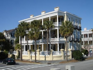
Here is an example (snapped from a moving vehicle through glass) of a "single house," meaning that it is the width of a single room, set sideways to the street. The porch, called a piazza in Charleston, faces a side yard, rather than the street. Lots of these single houses here. With more time, and a warmer day, it would have been nice to stroll these neighborhoods, peeking into the yards and gardens.


After the tour, we found the Charleston Crab House for lunch. It has a nice waterfront view. Newspaper clipping on the wall quoted Serena Williams saying it was her favorite Charleston restaurant. Note the upside down sign. The owner is a friend of the folks who do the Flip This House TV show and they had remodeled the restaurant and flipped the sign to commemorate the event. I tried the house specialty - she-crab soup, containing roe and crab meat. Very tasty. The reference says orange-hued crab roe was added to crab soup to give it some color. Susie didn't want to even think about it.


After lunch we did some more driving and gawking. The tour had taken us by the original Citadel campus downtown, so we drove to the current campus a little further out.


The above Charleston link, to Wikipedia, focuses on the Citadel's role in the Civil War. Cadets from the Citadel fired on a Union ship entering Charleston harbor three months before Fort Sumter was fired on. Sherman spared Charleston from destruction, as he had earlier spared Savannah.


Old churches and old cemeteries fascinate me. A signer of the Declaration of Independence and a signer of the US Constitution are buried in this cemetery in the yard of the church below.


Though we had lunched rather well, we decided we would (over-) indulge again, this time stopping at a seafood grill near our campground. I had seen shrimp and grits on the Crab House menu and decided to try it here. The reference says "shrimp grits" is a traditional Low Country breakfast, now fancied up. But, grits isn't just for breakfast any more. (Do you remember Bubba, in Forest Gump, listing all the ways you could fix shrimp? I'm sure shrimp grits was in there.) Mine had some spicy brown gravy over the grits, with shrimp arrayed over that. Good stuff.


So, that was our Charleston day.


Cheers,


Susie and Rob


Thursday, January 15, 2009

Going North

Sunday, 1/11, we bade fond farewell to Key West and headed north. Here's a picture of full moon rising followed the next morning by sun rising.


Decided we'd like to see Lake Okeechobee, that big hole in the Florida peninsula. This is the second largest lake wholly within the US, after Lake Michigan. So, we chose a route that bypassed Miami (and its toll road that we contributed to generously on the way down) and angled up to Okeechobee. Bypassing Miami took us through downtown Homestead and then through a long rural stretch lined with nurseries. So this is where all the landscaping palm trees, in the various varieties, and other flowers and shrubs come from! (Which reminds me: After our Key West guide had talked about various Democratic presidents who came to KW, he pointed out, for balance, at one point: two Bushes.)


At the town of Pahokee we stopped and walked up on the dike surrounding the lake. Been there, got the picture:

Not the greatest shot, but it'll have to do. From the internet, here's a satellite picture and a more interesting snapshot. Pahokee's at about the 4 o'clock position on the lake shore.


From Okeechobee we angled over to the coast and found a nice RV park near Vero Beach. I always wanted to make it to Vero Beach when the Dodgers had their spring training there, but didn’t. It was described as an idyllic setting, what spring training used to be like before it went bigtime. Now, alas, the Dodgers’ spring training camp has moved to Arizona in, I’m sure, a more revenue-driven atmosphere.

Another reason for a Vero Beach stop was the chance to visit Jose Daniel and Dharma Flores. Jose Daniel was the St. John’s choir director until moving to Vero Beach six years ago. We had a great visit, catching up on family news and church things, his and ours. As friends of Jose Daniel’s would expect, he’s very busy, choir-directing, playing the organ, and organizing concerts. The church he is in hosts several community concerts during the year. They have a lovely house and live in one of those nice neighborhoods with ponds and lighted fountains spraying therefrom. (We were after dark and couldn't see anything else.) Their Albuquerque time was special to them and they hope to visit some time. Almost did recently to celebrate an anniversary, but they had the option of taking a cruise on which their daughter was working as a dancer, so that was hard to turn down.


From VB we traveled on Monday to Jacksonville, where Susie’s sister-in-law, Joyce, and her husband, Jay, were working a Habitat for Humanity house project. As many of you know, they’re full-time RVers and travel extensively for Habitat projects. Our RV paths have crossed several times and we always enjoy being with them. We camped near them in a cozy, heavily-forested city park in Jacksonville Beach, the Kathryn Abbey Hanna Park, just a short walk from the beach. The weather had changed considerably – much cooler and raining. It was going to get worse. Jay and Joyce took us on a drive around the area, then we had dinner at Outback - kept my streak going with shrimp on the barbie .


When we got to Jacksonville I called my brother, Lael. They were moored there before and after Christmas making preps for their big sail, but I didn't know if they still were. I said, We're in Jacksonville. He said, We just sailed into Key West! Oops. If I'd only called two days earlier. We did do them the favor of pointing them to the Hogfish Bar and Grill. They're going to wait for a good weather window for crossing to the Panama Canal. Maybe we can meet them in Tahiti some day.


Tuesday we proceeded north, bound for Charleston. It was raining all the way and conditions were made worse by construction all across SE Georgia on I-95. This meant narrow lanes, bounded by either orange barrels or cement barriers. The cement barriers were used on the bridges, of which there seemed to be as many as on the overseas highway to Key West. Throw in a steady stream of semis constantly passing me and it was white-knuckle time.


Fought it for about an hour, thinking, surely we’ll get out of this construction zone soon, then finally gave up and got off and took very serene back-country (Low Country) roads to Charleston. Resolved to cut back on interstate driving the rest of the trip. I greatly admire the Eisenhower interstate highway system and the trucking industry that uses it, which seems to me to be a healthy mix of independent entrepreneurs and government oversight and infrastructure, to use a political term du jour, but leisure traveling in a motor home doesn’t always fit into the equation. Non-Interstate four-lane highways are the ideal, I think.


In Charleston, we stayed in a very nice campground in a city park on James Island. We picked it because it was the closest to downtown Charleston. So, both here and in Jacksonville, we found excellent RV parks in city or county parks. I don’t know if they’re money-makers, but I hope so. Would like to see more of these.

Here's a shot of Tuzi in the campground. Note the small mirror atop the right mirror (on your left) that is missing from the left mirror. After the bird dislodged the glass on that mirror, I removed the mirror frame. Will probably do the same on the right because I don't really use that mirror. It's a fish-eye mirror and the large mirror unit already includes a fish-eye. I've got redundant fish-eyes on the right side.

Also want to say a good word for GPS guidance. Both this park and the Jacksonville park would have been very difficult to find with a navigator anticipating and finding all the required twists and turns and communicating instructions to the driver. The parks were miles from the major highways into the cities, for one thing. Miss Magellan tells us, Left turn in point five miles, and, by golly, she’s almost always right. I haven’t updated my maps for a couple of years and that can confuse Magellan a bit. Leaving Jacksonville we were apparently skimming across creeks and marshes.


Next day, Wednesday, 1/14, we did Charleston. I’ll do a separate posting on that charming city.


Thursday, we proceeded north, avoiding I-95 and its brethren. Took us forever to get out of the Charleston environs, but we have a day and a half to get to Raleigh, so no sweat. To the extent possible, we struck out generally straight north, ending up on US 1 in northern SC (didn’t see any wayward Key West trolleys). Along the way the terrain changed from coastal low, flat country to rolling farmland and woods. Also, some very charming (to our eyes) small towns in both SC and NC – stately, well-maintained homes, wrap-around porches, nicely landscaped, … . Wanted to stop in a couple towns, but convenient parking places didn’t pop up when we needed them. I generally try to keep my eyes open for a country cafĂ©, but today we had lunch on crackers and cheese in a shopping center parking lot. Then just a mile down the road we passed a barbecue joint that is apparently the local favorite, with room for big-rig parking, too. Darn!


From our Trailer Life campground guide, we picked a campground in Pinehurst, NC, only about two hours from our Cary destination, which is the Jordan Lake state recreation area west of Raleigh. Well, in spite of our GPS’s best efforts, we missed the fairly obscure turn-in to the campground. The Plan B entrance required a “sharp right turn” and that was too sharp and steep to negotiate with low-hanging trees to boot. Also, there were no signs, commercial or official (the little blue RV symbols) indicating there really was a campground down these uninviting roads, so we kept on going. This part of NC has many golf resorts, but I guess golfers don’t drive RVs (though some pro golfers do, I know), so there was nothing else in the area. It was late afternoon, but we decided we could get to Jordan Lake before dark.


We just did, but by the time we had selected a camp site (out of a couple hundred available – the Ranger who collected our payment said we were probably the only persons camping, what with a forecast low of 19 degrees) it was dark. I knew ahead of time that the Parker’s Creek campground was the only one open, so that’s where we were headed. Been there before, but not absolutely sure where the turn-off was and whether it was north or south of the highway and couldn’t program the campground into the GPS. I was going to do this sort of just-in-time planning (find a campground map) in the wi-fi-equipped campground in Pinehurst. Saw a brown state park sort of sign that mentioned Parker Creek, but not campground. I turned off, not wanting to risk overshooting our destination. Sun is sinking lower. No applause tonight. It was soon apparent that this was not the road. So, we’re winding down a narrow, wooded country road, not knowing when, if ever, we could turn around. Susie says we need a circular driveway and, like a miracle, a church appeared with such a driveway. One low branch swiped us, but we got turned around. Back on the highway it wasn’t long until we saw a sign alerting us to campgrounds and telling us which lane to get in for Parker’s Creek. It doesn’t take a GPS to find a campground here. Backing in to our site in the dark was an adventure, but with great deliberation and patient discussion we did fine. Managed to keep warm enough on a very cold night. Here's a picture of ice sculptures on the lake shore the next morning - formed by waves splashing onshore.


There was a major drawback with Parker's Creek: the campground gate is locked at 6 pm. No exceptions. Kind of hard to have dinners and a birthday party in town with Mike, Karen, and Jason with that curfew. (In the summer, the curfew is 9 pm.) So, we packed some clothes and spent Friday, Saturday, and Sunday nights at Mike's. Locked up Tuzi and set the thermostats down and stored her for the duration. If the weather had been warmer, Jason might have come out and stayed a night and day with us, but that didn't make sense now.

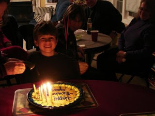
Friday was Jason's ninth birthday. The party was a pizza party at home with guests of both sets of grandparents and one of Jason's soccer buddies and his family. Here's the traditional cakeandcandles picture.


Mike had started assembling his and other cruisers' pictures into an album using the versatile Blurb software - free on the internet and Saturday, he, Susie, and I worked on selecting photos and formatting the album. Karen and Jason worked on assembling a large Star Wars Lego space ship and Karen continued helping on the album, also. Going to be a great memory book for all the Susie-cruisers.

Sunday we attended Mike and Karen's church (thought-provoking service that connected baptism and communion) then watched football (put in your own clever parallel construction here: ____________________). Mike and Jason both had Monday holidays so our initial plan had been to spend the day with them. Also had planned to stay over Tuesday so we could watch the Obama inauguration. But, starting to feel the need to get home, we thought we'd drive a half-day Tuesday, then stop for TV. (Of course, we could keep up with the preliminaries via our in-motion tracking satellite dish.) Also wanted to squeeze in a visit to our friends, the Dietzels (former Albuquerqueans and St. John's members), in nearby Sanford.


We were nearing completion of the cruise album Monday morning when Karen called and said, Have you heard the weather forecast - 2-4 inches of snow tonight? Her company was starting to make emergency plans. The local TV stations were running breathless bulletins. We decided to leave forthwith. Left at noon, visited the Dietzels, went back to campground, hooked up Tuzi, and left Parker's Creek at 3 pm. Our goal was a KOA near Statesville, NC, about 130 (mostly non-interstate highway) miles west. Got there about 6 pm and are now comfortably settled in.


Cheers,


Susie and Rob

Wednesday, January 14, 2009

Dry Tortugas

Saturday we took a day trip out to the Dry Tortugas National Park - about 70 miles and two hours west of Key West - traveling aboard the Fast Cat catamaran. (Key West is not the westernmost key in the US.) Friend, Dick Reinert, has been to KW at least a couple of times and highly recommended this trip. Ponce de Leon, in the early 1500s was the first European discoverer of this group of small islands and he named it for the turtles in the areas. Dry was added later to denote that there was no source of fresh water.


The centerpiece of the park (unless you're a birdwatcher) is Fort Jefferson - a massive fort built to protect shipping in and out of the Caribbean (more info at this Wikipedia website). The National Park (so designated in 1992) began its federally protected status as a wildlife preserve - fish, birds, and coral reefs, so wildlife management is part of the Park's mission. I thought it was interesting that our guide for a tour of the fort was a tour employee, not a Park Ranger.


The park covers about 100 square miles - seven tiny keys and surrounding water. Here are a couple of internet pictures of the fort:


The sea wall and moat surrounding the fort were for protection from hurricanes as well as attackers.


The fort is huge: three tiers, designed for 450 guns and 1500 men. The six sides range from roughly 300 to 500 ft. in length and it covers 11 acres. (Quick. Somebody work that out in units of football fields.*) There are sixteen million bricks in it - the largest brick structure in the western hemisphere. Construction started in 1846 and continued for 30 years, but the fort was never finished. There was never a shot fired in anger, nor was that too likely, in my humble opinion. Marauding pirates and the young country’s enemies could easily stay out of range. However, the fort’s main function was to provide a safe anchorage for US patrol ships that operated in the Gulf providing protection for US shipping. Additionally, if an enemy held this location, that would pose a serious threat to the US – so keeping it in US hands was essential, at least for a while.


Maintenance costs and climate made it hard to justify its continued use as a fort. I suppose changing world conditions made it less strategically important. In 1888 the Army turned the fort over to the Marines for use as a quarantine hospital. In retrospect, you have to wonder if it was all worth it. At the least, could its mission have been accomplished with a less grandiose fort? Who knows? It's mind-boggling to find this huge fort on a tiny, remote island. Thanks, Dick, for making us aware of this piece of history.


During and after the Civil War the fort served as a prison and its most famous inmate was Dr. Samuel Mudd, who treated John Wilkes Booth after he assassinated Abraham Lincoln. For this, Mudd was convicted of conspiracy. He was subsequently pardoned by President Andrew Johnson, in part for his work at Fort J combating an outbreak of yellow fever. Here's Mudd's dungeon room.


Here are a couple of my fort pictures:


The fort was built with numerous cisterns beneath it and a drainage system for capturing rain water and channeling it into the cisterns. Unfortunately, part of the fort subsided and damaged many of the cisterns so that they were unable to collect more than a small part of the water needed for soldiers and prisoners.


Sidebar. The first engineer sent out to evaluate the site's suitability for a fort said it wasn't suitable, in part because of soil instability, which, it turned out, doomed the cisterns. His advice was rejected by the Army and the next evaluator said the site was suitable and so the fort was built.


Another innovative feature was "Totten shutters." These were hinged iron plates that covered the gun openings. They would be forced open when a cannon fired, by the gases escaping from the cannon's muzzle, followed shortly thereafter by the cannon ball. A stuck Totten could ruin your whole day. Over time the shutters have deteriorated. There is ongoing restoration work at the Fort, replacing bricks and rebuilding walls, and eventually restoring some of the Totten shutters.


Susie sunned on this beach while I climbed around the fort. We both tried snorkeling a bit, but there wasn't much of snorkel appeal in this area, at least when we were there. There is a coral reef 100 yards out, but we weren't too keen on flippering out there. We were keen on relaxing and reading on the beach.


Our guide told us that today some 1200 Cubans a year land on the Dry Tortugas seeking asylum. There’s a dry/wet rule that if you make it to land, you get asylum; if you’re picked up offshore, not so.


I mentioned earlier that the industry that gave Key West its start was Wreckers. They also worked the Tortugas. The same Wrecker who built a too-short lighthouse on Key West did the same thing on the Tortugas, said the guide.


We were on the island for four hours. A day of history and sun. On our return to KW the seas had picked up considerably, so the Fast Cat had to slow down occasionally as we bounced along the waves (these may not be official nautical terms). Couldn't help but think of my brother and his wife who are embarking on a sailing voyage from the East Coast, through the Pahama Canal, and across the Pacific to Australia. Bon Voyage.


We left next day bound for Raleigh, NC, then home by whatever route the weather dictates. We have heard stories about snow and ice in the upper 47, but we're not sure whether to believe them. It's nice enough here!


Cheers,


Susie and Rob


* 11 acres equals 13.3 football fields.