Tuesday, August 20, 2013

USA -2


Loose Ends:

Traffic Signs.  In Quebec, probably because of the French/English mix of their population and visitors, many road signs are graphical - no words.  E.g., No right turn on red was graphical.  (A Grey Line guide said the Quebec population is 70% French heritage, 20% English, 10% other.)  I learned, on trying to enter a parking garage and encountering a barrier, but no ticket booth, that Sortie means Exit.  Luckily, I did this early in the morning and was able to back up, then jump a curb to get in the Entry lane.  If they had had an overhead drawing of an oncoming car, I might not have made that wrong turn.

In case you're wondering about bridge warnings of ice or snow plows: Ontario has no bridge warnings.  They assume if you're driving here, you oughta know.  Nevertheless, I was comforted to cross into Michigan and see the year-round Bridge May Be Icy signs.

Mileposts.  I Googled up some information about the one-tenth mile markers on some interstate highways.  A Wikipedia article about NY signs said:

This (1/10th mile-marker project) was initiated in response to the Highway Safety Act of 1966 enacted by Congress, in an effort to monitor traffic and identify high-accident locations. 

It didn't say when NY installed the signs.   Or what considerations determined which highways got them.  I haven't yet found any later, or national guidance on the topic.  I still suspect political shenanigans.

Eisenhower.  One of my favorite highway signs is this small blue sign. 


I think it's a nice tribute, though some people think it's not warranted.  To me the fact that one man (once a boy from Kansas) achieved two ultimate positions of leadership - five-star General and President of the USA - is astounding and worthy of recognition and remembrance.  I appreciate the interstate highways and I appreciate Eisenhower. 

I found an article that explained that the Eisenhower signs are optional, state by state.  (Maybe tenth-mile markers are, too).  I'm going to suggest that the NM Transportation Department install the signs because we don't have them.

Back on the road: Here is a picture of the yard at the shop where the pickup's water pump was replaced.  I found out, though, that they're about to move into a new modern shop on the highway (I-90/I-94).  The shop office manager was really excited.  There would be an actual bathroom.  Next to the trailer, just out of the picture, is the outhouse they use now and she hates it.


Here's one car in the lot.


Sweet little BMW.  The shop owner told me a sad tale.  It's his car and it can't be driven because he can't get tires for it.  Said his wife is really mad!

I had planned on a barn expedition in the area, but I didn't have wheels for that.  On the way from shop to town, though, I got these pix.


We left about noon for a fairly short drive to Albert Lea, MN.  Along the way we crossed the Mississippi.


We've been through Albert Lea (memorably, on the trip when we also visited the Spam factory in nearby Austin) a couple of times and Susie remembers a trip through there long ago that made her say, I want to live here.  The main feature is a large lake in town, ringed by houses, boat docks, and estates.  We found the road that circles the lake - mostly a one-way lane -- and did a circumnavigation.  Very nice.  A couple of pictures:


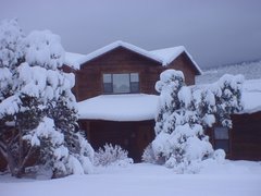
We stayed at a KOA in the country between Albert Lea and Austin.  Here's the rural view out our front window -- Field of Beans.

 
One thing we discovered when we explored Albert Lea: Now the A/C doesn't work on the pickup. (Update.  Had it checked when we got home; compressor needs to be replaced.)

Which brings us to Iowa.  Our next day's trip was across Iowa to a destination KOA south of Omaha, NE.  Lots of cornfields in SE MN and all of IA.  Heard an ag report on the radio saying that MN was expecting their second largest corn crop ever this year.  Prospects look good in Iowa, too.  When I look at those dense rows of corn stalks in those fields, I think of the scenes in "Field of Dreams" where the ghosts of old-time baseball players fade into the rows between the cornstalks. 

We drove S on I-35 from Albert Lea.  Then, rather than continue to Des Moines and catch I-80 going west to Omaha, as Miss GPS wanted, we exited I-35 at Ames and followed US-30 west, for the sake of variety and actually to save a few miles, if not time.  That made for a nice and relaxed drive.  I didn't reset the GPS, just waited until Miss GPS understood my objective.  I turned off her voice, so I wouldn't hear her pleading.  Before every N-S road we crossed, she flashed the screen with a big left turn arrow -- all the way to the banks of the Missouri River!.  Even after we turned south on I-29, she wanted us to go SE several miles to I-80, then make a V to the SW toward Omaha.  As mentioned earlier, I need to update the GPS.  Maybe Miss GPS will be a little more understanding after that.

Some people find mid-west farm country monotonous.  That's why so many Kansans live in Albuquerque.  But I like it a lot, especially compared to the tree tunnels you drive through in wooded areas.  Talk about bo-o-oring.  At least in wide-open farm country you can see the horizon and signs of life.  And, satellite radio reception is a lot better.


Time to go home.  I'm getting grumpy.

Speaking of satellite radio.  Was listening to Willie's Roadhouse, channel 56 on SiriusXM.  After a short while I recognized the tune playing as Somewhere My Love, set to a Texas Swing beat.  I thought, isn't that a tune from Doctor Zhivago?  Susie confirmed that it was.  After the song ended the DJ said, "That's a song from Doctor Zhivago, arranged for Texas two-step.  Maybe if they'd used that version in the movie, Lara and Yuri would have had a happier ending."

Drove cross-state on I-80 from Gretna (near Omaha) to Ogallala.  Made this drive several tmies when Jeff and Valerie Hinkle lived in SD, then IA.  The Platte River valley is pleasant country.

Next day, on to Denver and a half-weekend with Jeff, Valerie, Malia, and Macy Easterling.  Jeff did a Warrior Dash at the Copper Mountain ski resort on Saturday and I went along as a spectator.  The dash is a 5K run with several obstacles, notably a mud pit to crawl through along with rope and board challenges to get across or over. 

There is barbed wire over the first several feet of the mud pit to make sure you stay low and to keep runners from diving into the pit.  Here, Jeff emerges from the goo. 
 

Runners approaching the fire jump.


Finish line.


Shower line.


Back in town, Susie took Macy to Target to spend her birthday gift card.  Later some play time in the park.


When we left Cedar Crest, lo, these many weeks ago, we had planned a leisurely trip home from Montreal.  Target date for home was the last week of August.  But, once we point toward home, that tends to become the focus for us.  Plus, we had a couple of good reasons to get home a week sooner: Jeff's Warrior Dash and son Matt Hinkle's 50th birthday. 

So, on Sunday, August 18, we left Highlands Ranch at 5:00 am and got home mid-afternoon.  Drove over to Rio Rancho s little later and surprised Matt.  Enjoyed a dinner prepared by son, Tony, and general family-news catch-up. 


It was a great eight weeks.  Our longest trip ever.  Somewhere on our return trip I was checking the odometer and trip mileage and accidentally zeroed out the trip odometer.  Data-gathering can be difficult.  But, I estimate that we drove Tuzigoot about 5500 miles, maybe 6000.  Another 2600 miles in the pick-up!

Thanks for your company.  Always great to hear from you.  Even if it's only spelling or grammar corrections. 


Happy September,

Susie and Rob

Tuesday, August 13, 2013

USA-1

Saturday, August 10.  In Michigan, our goal was a campground on Lake Michigamme in the west end of the upper peninsula of Michigan.  We had stayed there several years ago in Tuzigoot 1.  As we were waiting to cross the border, I asked Susie, Do you know what I'm looking forward to?  No.  A pasty, I said. It's the defining food of the U.P.  Susie said she'd thought about that, too.

Wikipedia describes a pasty as "a raised semicircular comestible."  It's meat and potatoes and seasoning in a pastry.  The origin is apparently Cornwall, England.  It's a miner's meal. 

Most importantly, it is pronounced PASS - TEE, not PACE-TEE.  We've been in the UP a couple of times, so got to know pasties and the UP sense of humor.  On one of our trips I took a picture of Susie standing in front of a sign advertising Grandma's Pasties!

Folks up here refer to themselves as Yoopers ( U-P-ers), who are north woods rednecks.  Or, north woods Duck Commanders, if you know about them.  You can buy books and post cards, etc. featuring Yoopers and their activities.  Lots of fun.

Here's Lake Michigamme at dusk.


A train track runs through it (the campground).


Oh, look!  Here comes a train.


I was on my way to the shower house when I heard the train a-comin.'   It was a long train, mostly carrying timber.


We and Miss GPS had done the math and decided that we would stay two nights here.  So, Sunday morning we went to find the local Methodist church.  Found it, but, except for one pick-up in the process of leaving, the parking lot was empty.  Then, we saw the sign: services today were being held jointly with the Lutheran church in the Michigamme city park.  The exiting driver said, follow us to the park.

Here's a glimpse of the scene.


Both preachers spoke, and the theme was water.  We enjoyed the service and the setting.


We could have stayed for lunch, but we were on the trail of pasties.  Earlier I had asked the campground manager about where to get pasties and he had referred us to a café about 10 miles east of the campground.

On the way there, the check-engine light came on in the pickup.  I checked the oil, which was OK, and we continued down the way and got our pasty fix.  Several young guys and one gal, stereotypical Yoopers, it seemed to us, ran the café and were doing a good business, mostly take-outs.  We had come to the right place.

Going back to camp, the high-temperature light came on.  I stopped and checked the radiator reservoir.  Empty.  I was at a gas station, so I bought coolant and put it in.  A little further down the road, the high-temp light came on again.  The reservoir was still full, though.  We were close to camp, so continued on.  No more driving today.

Monday morning we set off for a KOA in Oakdale, in southwest Wisconsin.  Just before we exited Michigan, we stopped at a beautiful rest stop.


It had this strange contraption.


It was, the sign said, a stand for cleaning bicycles, in order to prevent invasive, non-native plants from being spread!  Thus, there were hooks to put your bicycle on, brushes to brush off tires, chains, pedals, whatever.  Also, an air pump for blowing minute seeds off of your bike. 

But, but, but ... by doing this you're scattering non-native, invasive seeds all over this lovely park, we thought.  The device looks new and/or little used - all a little strange.  If anyone has info on this subject, please let us know.

After setting our GPS for Oakdale, I put in the waypoint of Rhinelander, WI.  The map showed that the road through there was a scenic route, so I wanted to go through there.  But, Miss GPS had originally picked a different route, so I put in the "via point" of Rhinelander to overrule her.

When we got to Rhinelander, the GPS had me turn off on a major city street, but not one designated as a highway or business route.  The reason, I quickly realized, was that I had selected a meaningless street address in Rhinelander as the via-point. I stopped and checked the GPS map and could see, though, that the road we were on eventually connected with the highway we wanted, so we continued.  Miss GPS told us when to turn right, but, that road was closed because of a bridge repair project.  For several blocks, Miss GPS told us to turn, but they were all streets closed for repair.  I could see us dead-ending in an awkward place, but I kept my cool (Susie later said she was proud of me.)   I consulted the GPS map and found our way to the highway we wanted and we continued on.

Susie had said, shall we have lunch here in Rhinelander.  I said, No, we'll find a roadside park down the way.  Well, we kept driving and driving for two hours: no roadside tables or rest stops.  Also, we were on four0-lane highways, limited access, so it was hard to pick an exit.  Finally, in the GPS map I espied a cross highway. I took the exit.  Turned out to be a new four-lane highway, not yet in my GPS memory bank.   But, it was nice, trafficwise.  We came on to the campground and had late lunch.

In Oakdale, I drove the pick-up to the nearby post office to mail a couple of letters.  There and back, no indication of an engine temperature problem.  But, when I checked the radiator reservoir, it was empty.  The KOA manager referred me to a local mechanic and I called him.  He said, meet me over at the truck stop adjacent to KOA and follow me out to my shop, which I did.  It was quite a scene - a collection of several vehicles in various stages of decay, dogs and cats lazing about the yard, and a couple of Yooper-style mechanics working on a car and a pick-up.  One of his guys diagnosed the problem as a leaking water pump.  This was late in the afternoon.  He had his office manager, I'll call her, drive me back to KOA.  Said we'll come get you in the morning when we get the water pump installed.  As this is written, it is Tuesday morning and I am waiting for the call.

The office manager had quite a story.  She had been a Wisconsin Highway Patrolman for 20 years, had assorted jobs subsequently, and now was working part-time for my mechanic.. When I mentioned New Mexico, she told a border story.  Friends of her daughter, I believe, two guys and a girl, had gone to Tijuana to party.  They got separated and when the guys couldn't find her, they left.  Approaching the border, they saw her in a car behind them, sitting between two guys.  They told the border agents.  When they stopped the following car they found that the girl was dead, but had been cut open and her body stuffed with drugs.  Unbelievable, but maybe it happened.  My driver said this episode served as a warning to her daughter about being careful who you associate with.

Late Tuesday morning, our pickup was repaired, so we loaded up and continued west and south.


Susie and Rob

O Canada!

Friday, August 2.  We entered Canada at a Vermont border-crossing.  Tuzigoot got searched and we had background checks run. 


The agents were two pleasant young men.  One asked, What do you do?  I said I'm retired.  Why are you going to Montreal?  To attend a convention.  If you're retired, why do you go to conventions?  Well, I do some occasional teaching.  They were just killing time while we were electronically vetted.

Driving through this part of Quebec from the Vermont border to Montreal was like being back in the Midwest -- mostly flat land with fields of corn and handsome houses and farms.   Miss GPS led us around the city, staying south of the St. Lawrence River, to the Montreal South KOA.  This campground is about 15 miles SW of downtown.


Saturday we took a Gray Line Hop On and Off city tour to see Montreal highlights. 


That's Susie up there in the cap.  Don't hop off!

We hopped off and had lunch in this area where Marc Chagall decorated a street turned promenade with lots of strings of  lots of pink spheres.


We were exposed to art as we drove by the modern art museum.  The artist who created this piece of glass art, titled bad hair day (I just made that up), is Dale Chihuly.


This imposing church is St. Joseph's Oratory (I'm using Anglicized names rather than the French, which is usual in Montreal).


Brother Andre started his religious life as a doorkeeper at the University of Notre Dame, across the street from the hill where this church was ultimately built.  He later came to lead a worship center on that hill and became a widely sought counselor, spiritual advisor, and healer.  His advice to those seeking help was generally, Pray to St. Joseph.  (Mary's over-booked; no waiting for Joseph,  That's how I would summarize it.  Remember the movie, Bruce Almighty?  We watched it on TV one night on the road.  Bruce (Jim Carey) played God for a time and had more prayers to answer than he could cope with.) 

Brother Andre developed such a following that this basilica was built to accommodate it.  It was completed in the 1960s.  Brother Andre died in 1937 at the age of 91.  Over a million people attended his funeral rites, it is said.  He was declared a saint in 2010.

We didn't go into the church because it was late in the day and only one or two more buses would stop here this day.  I came back the next morning (our hopping tickets were good for two days) and went inside.  (The meeting of the American Statistical Association started Sunday afternoon -- geeks and nerds -- so Susie opted to stay at the campground.) 

Sunday services were in progress. 


This sanctuary in a lower level is called the crypt.

Here's the main sanctuary.  Took this picture from the family room, a glassed in room at the back of the cathedral where children can move about and make noise.


Very modern looking.

By way of contrast, here's the Notre Dame Basilica, just a block away from the Convention Center where my meeting was held and where I parked the two days I drove in.  I had wanted to see it Sunday, but was turned away by a guard who asked, service, or just look?   The Gray Line guide told me later, Just say service.  They want you to wait and pay to go in and look.

Early Monday morning, I went in.  Was astounded by the sight!


The colors, the woodwork, the statuary, the sheer size.  Awesome.  I sat for a while just to soak it all in.

The article at the link says that the architect, James O'Donnell, an American, was so overwhelmed by his creation that just before it was completed (in 1879) he converted to Catholicism on his deathbed.  The link also lists the artists who created the interior.

Just down the street I stepped into a small café and deli in search of breakfast.  Was having difficulty ordering because of the language barrier, so the owner told me to sit down.  He'd bring me breakfast.  And a fine one it was: two eggs over easy, potatoes, bacon, toast, jam.  Perfect.  I went back on Tuesday for an encore.
 
Meeting went well - heard some talks that kind of reinforced some of my views of how statistics should be taught.  There were two tribute sessions to statisticians - one who recently died, one who turned 90 and is still going strong - that I have known and been influenced by.  Also, some material to work into the book I'm writing.  Had a productive meeting with a publisher's rep.  The journal I edited, way back in the 80s, has an annual dinner and Susie and I went to that one evening - another chance to see old friends.

One reason we picked the Montreal South KOA was because it was near a train station from which I could commute to downtown.  The train had a limited schedule, though, so I just used it once.  A couple of friendly agents helped me negotiate the ticket machines and find the return train.

On Wednesday, we took a drive along the St. Lawrence River.  Started out with a plan to drive up the south bank, return by the north. After a while it dawned on me that we should have done the opposite.  That way the river would always be on our right, which would make for better viewing and opportunities to pull off. 

In one village the GPS showed me a waterfront park, so we found our way down a little lane to that.  The park featured a tribute to a pioneer woman.  Because the statue was under repair, there was no information about who she was.  Susie called to another person in the park: Do you speak English?  He said he did.  We asked about the pioneer woman.  He didn't know who she was but she had shot some Indians back in pioneer days.  She's toting a rifle up there on her pedestal.


And here's her view of the river.


Not long after this stop we saw a sign for a ferry. Love those car ferries.  We could cross the river and thus continue our trip with the river always on our right.  The way was not well marked, but we found the ferry and took it across the river. 


The landing point was on an island just off the north shore.  We drove around the island, looking for a place for lunch.  In one village two old guys and a school girl told us in a mix of French and English, that it was right up the road, second stop, turn left.  We couldn't find it.  We kept driving on up the river and checked out a couple more villages.  No luck.  Drove through some very nice areas, though, featuring large, gorgeous estates bordering the river.  Finally found some lunch and soon after reached our goal, one of the few bridges across this stretch of the river.  We crossed and headed back toward Montreal.

Oh, the roadside café we found featured six (!) life-size cow heads, animated - their heads swayed back and forth, back and forth, ... .


Coming back we came across this impressive church in Pierreville. 


Most every crossroads and hamlet in the area was named for a Saint.  At last, some respect.


Finding Saint Robert took us off the river road (on the north bank, it's called the King's Road; on the south bank, it's called the Navigator's Route).  I used the GPS to work our way south.  Most of this area is a grid with diagonal roads relative to North-South, East-West.  We zigged and zagged, often on some pretty minor roads, but eventually got home.  GPS is wonderful.  Would never have done this sort of boon-docking before.

Thursday, as we prepared to leave and HEAD HOME the living room slide-out would not retract.  Oh, no!  I went to the office to ask for a reference to an RV repair shop.  The lady on the desk said, I'll call our handyman, Bernard - an employee of the park.  He came over and quickly found that the long bar that the motor turns to move the slide-out was broken - twisted like a pretzel.  Something had jammed the slide-out - I don't recall it sticking and me forcing a closure - and the force of the motor twisted the bar until it broke.  What now?  Bernard said, I think I've got a replacement in my shop.  And he did!  He put the new bar in.  The slide-out wouldn't move.  Bernard went looking and found what looks to be a half-inch piece of a rivet that had broken off and lodged in a bad place.  Now, everything worked.  Best service ever!, I think.

So, we headed west toward Sault Ste. Marie, Ontario, from where we would cross the border into the upper peninsula of Michigan.  Getting out of Montreal was difficult due to construction and traffic.  In hindsight, I realize our GPS is outdated.  Looking at the atlas later, there looked to be a better way.  Live and learn.

If you want to check your Ontario map, our route was highway 17.  We started counting the miles and deciding when we wanted to get home.  The only particular goal is to make a stop in Denver to see son Jeff and family.  On day two of this trek had probably our longest day - 375 miles.  That got us to a KOA in S.S. Marie.  One of the best parks we've been in.  The owner couple is a former USAF Thunderbird pilot and his wife, a champion dog trainer.  One service they offered was to weigh your motor home. (They'll also help train your dog.)  Knowing its weight and how it is distributed over the six tires is important for safety and reliability.  I've read articles about the importance of knowing your motor home's weight, but never had Tuzi weighed.  Thought about it often as we drove by truck weighing stations, but wasn't sure they would weigh us.  Just relied on the assumption that Allegro and Michelin had us set up properly.  The weighing showed we were within limits, though a little unbalanced, left vs. right.  (That's not a political statement.) 

Crossing the bridge into Michigan, USA, was very slow. 

 
Here's where Lakes Superior and Huron connect.  The word, sault, means rapids or falls.


The Border!

My copilot.

Once we got to the Customs agent, he just had a few questions and we were good to go.  Which reminds me: the day before we had stopped at a roadside stand and bought some fruit and vegetables.  While chatting with the KOA owner, the subject of border crossing came up and he asked if we had fruit or vegetables.  Oh, oh.  He said, those will probably be confiscated, if they ask.  Susie said, Could we leave the food with you?  He said, OK.  He had an employee who was in a tight situation and could use the food.  So, that's what we did.

Next stop: a campground on Lake Michigamme where we stayed once before, several years ago.

Susie and Rob

Friday, August 09, 2013

New Hampshire

En route to Montreal, we spent two nights in mid- New Hampshire, at a KOA near Woodstock.  It was almost deja vu all over again.  Soon after we set up, there was a knock at the door.  Young man asked me to go over to the office - there was a mix-up in site assignments.  We were in site 2; manager thought she assigned me to site 1 and had subsequently sent somebody else to 2.  However, she realized her mistake and re-assigned the second party.  The next night, though, might be a problem.  Site 2 had been reserved to someone who had requested that site and we had been assigned it for two nights.  But, she thought she could take care of the problem without moving us.  And, she did.  However, we spent the whole next day traveling this part of the state and were not available, just in case.

First, here's the Pemigewasset River as it flows past our campground.


We drove east from the nearby ski resort town of Lincoln, through the White Mountains.  Main destination was Mount Washington, home to what is proudly claimed as the worst weather in the world. Here are a couple of mountain scenes along the way.


There was a legend posted here about a young woman who had been swept down these falls and disappeared.  Her companions tried desperately to find her and couldn't.  They worked for hours to divert the river so they could better continue their search.  One of the searchers plunged into a pool, felt a hand, and pulled.  There was an answering squeeze on his hand.  Somehow the woman survived, perhaps because the frigid water preserved her cryogenically.  As this is written I can't find my notes on this story, but if I find them, I will update you.
 
 
Mount Washington is known for having the world's worst weather, strong wind in particular.  Back in the 80s for several summers I came to a conference in NH.  I did some exploring in the lake region south of here, but there wasn't time available to make a trip to Mount Washington.  It's been on my bucket list, so now was the opportunity.
 
There are three motorized choices to get to the top: drive yourself, ride up in a van with a guide, or cog railroad.  I opted for the guided trip.  This would give me more opportunity to see the sights and not have to worry about the narrow road with severe drop-offs and no guard rails.  Because Susie doesn't do well with heights and drop-offs, no matter who is driving, she elected to stay below.
 
Here is a picture on the way up. 


On this day clouds moved on and off the peak. 
 
The cog rail train arrives - an engine and one car.   

 
This building is the office and gift shop of the van line.  Note the chains that anchor the building to the mountain to keep it, the building, from blowing away.

 
Still the record high wind speed observed by man. The gage broke before the storm was over, so who knows if even a higher wind speed was observed? 


There were some hilarious videos playing in the visitor's center that showed people and things being blown around.  One guy was trying to pour a glass of milk, but the milk streamed off horizontally.
 
Our guide, Eric, told us that there is a waiting list of meteorologists for government job openings on top.  Also, a waiting list to be the Weather Channel’s reporter on Mt. Washington.  The weather station is staffed year round (provisioned by snow-cats in the winter)

Successful summiteers.


Had to take my own picture.
 
Mt. Washington is one of three presidential peaks in this range.  The other two being Jefferson and Madison (check?).  MW was named for George, however, before he was elected.

 The road project was started in 1853 and the road opened to carriage travel in 1861. The first automobile to the top was in 1899.


They have races to the top: running, biking, driving.  The road has an overall grade of 12.5% - one mile of elevation gain for eight miles of road.  The record for a car is just over six minutes– unbelievable.  I asked about accidents or fatalities.  None on the road (well, maybe some scrapes), but no incidents of a car going off the road and plunging down the mountainside.  There have been injuries and fatalities of hikers on the mountain.
 
On Eric's recommendation we stopped at a nearby waterfall.
 
 
Our White Mountains loop (they were named this because the mica schist rock on the mountain has a white sheen) continued north, then west, then south to dinner in North Woodstock, then camp (and no request to move).  A nice day in the mountains.

Susie and Rob