Arizona
Our route home from Las Vegas was loosely planned (is that a surprise?). We wanted to spend some time in Arizona, possibly
in the Phoenix area, for spring training baseball
games. So, just east of Kingman, AZ, we
took US 93 SE toward Phoenix. I’d never
been on that highway, that I remember, and some of it was marked “scenic” on the map, so
that looked inviting. Turned out that
scenic meant frequently two-laned. But,
there were rugged mountains to look at and some interesting areas of saguaro cacti and Joshua trees.
We had not made any reservations in Phoenix, but thought we might
first spend a few days in the Sedona area and plan subsequent AZ days. The shortest route from Kingman to
Sedona is to take I-40 from Kingman to Flagstaff, then south to Sedona. But, that involves some pretty steep ascents
and descents. And, lots of rough
pavement on I-40. Hence, the decision to
skirt around the Mogollon rim country and to stay in an RV park in Camp Verde, about
25 miles SE of Sedona. This meant we went SE on 93 to Wickenberg, then east to I-17, then back north to Camp Verde. Once we got there, we decided to stay through the
weekend – five nights total. Quite a bit to see in the area, plus I was not looking forward to encountering Phoenix or the drive back up I-17 on the way home. Next year, spring training - maybe. Depends on how well the Lobos do.
[I have some Camp Verde history. Way back in 1987, friend Roger Eaton and I rode in the "Almost Across Arizona Bike Tour." Started at the south rim of the Grand Canyon (hence the "Almost") and bicycled to Nogales. This was an organized tour: a truck hauled our tents and sleeping bags and the tour company arranged camping at parks and football fields (I recall the water sprinklers coming on during the night we were camped on the Flagstaff HS field) and meals at schools or churches or country clubs, even. From Flagstaff we rode to Camp Verde, by way of Sedona. The next day's ride was to Payson. This required a long climb and finished with a decent descent. But it was a tragic day. One of our riders was killed when struck by logging truck when the truck's trailer sideswiped the rider. We got snippets of information as we rode to Payson. Roger and I were not riding together and didn't know who the victim was for sure until late in the day. We both worried it was the other until we found out. I shudder just thinking about it. The rider was from NY state and was on the tour with his wife. Several riders left the tour after that tragedy.]
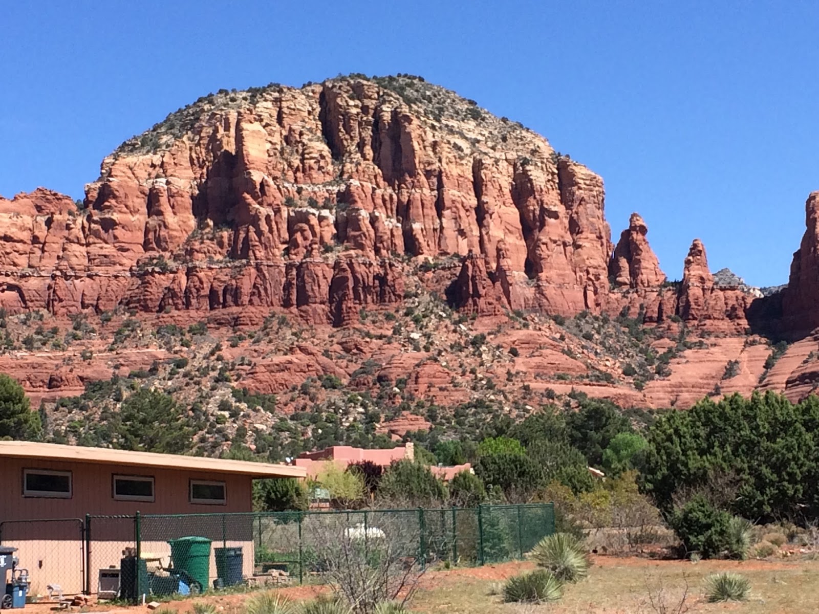
Sedona
Thursday, we drove to the hot-spot of
Sedona, known for its fabulous red rock scenery, and new-age vortices and the like. There are lots of pictures at the linked VisitSedona website. Traffic was already heavy, as Easter weekend, also a time for many school spring breaks, approached. I found out the next day that this week was by far the most popular time for tourists to visit Sedona. Going into Sedona I pulled into a shop advertising tourist info. I decided to sign up for a jeep tour. Turned out this office was a front for a time-sharing resort. If I would listen to a 2-hour pitch I could get a jeep tour free and $50 cash, I believe. I've done a few of those, but not this time. I bought a ticket straight-up. The time-sharing agent called the Jeep office and made a reservation for me for Friday.
Friday morning when I showed up at the
Pink Jeep office, they didn't have my reservation. Let that be a lesson. Fortunately, I had a receipt and they had a spot available on the tour I wanted to take. Here's the staging area in downtown Sedona:
They sent out about 20 jeep-loads bound for different 10 o'clock tours . This is a big operation, and well-organized. Our guide said the company has something like 75 jeeps, all modified from stock jeeps in Pink Jeep's mechanical shop for their tour purposes. I was on the
Coyote Canyons 'rugged' tour - the alternative was the easy or
sissy tour. We didn't do any technical boulder-crawling like you may have seen; we just drove a moderately rough and rocky backroad that required a high-clearance vehicle.
Our guide and driver was Dan Swan. He was great - told us a lot about the geology of the area and the human history and the history of Sedona.
(I usually take notes on tours for subsequent blogging, but
that wasn’t possible on the terrain we covered.
So, I’m going by (limited) memory. You could look it up - the history, I mean.)
The idea of pink jeeps came about this way. A man and his wife, whose names I don't know, started one of the first jeep-tour companies in Sedona. He had been thinking about how to better market his tours. He and his wife were on vacation in Hawaii, staying in the Royal Hawaiian hotel, which happens to be a pink stucco building. She noticed that the golf carts and other vehicles at the hotel were also pink. "There's your marketing angle," she told him. Paint your jeeps pink. People will remember pink and tell their friends about the pink jeeps at Sedona. If it was just Jackson's Jeeps, say, they wouldn't stand out. And thus a very successful business was created. Kind of like Bill Gates or Steve Jobs.
As an artsy-new-age and wealthy-retiree community, Sedona is rather quirky. Dan said the latest development was that the town, after much debate, had decided to allow street musicians, but only on one side of Main Street. Sedona straddles two counties, so making decisions is not easy. He also noted, when talking about how the indigenous pueblo-dwellers, called the Sinagua people, had moved out around 1400 AD, just as they did in New Mexico, that if you took a poll of Sedonans, 65% would say the Sinagua people were abducted by aliens from another planet. Dan also told us quite a bit about the Sinagua's creation stories and how they related to the land.
Here are a couple shots from the jeep ride:
That's not a particularly daunting piece of road, but we were not moving and rocking so I was able to take a picture.
I was fortunate, because as a party of one I got to ride shotgun. The other passengers in the back of the jeep were a couple from Scottsdale, and a couple and their high-school son from Nashville. They mostly tried to top each other with stories of where they'd been and how important their jobs were. I didn't have to even act interested.
So, it was a great tour. If you're ever in Sedona and want to take a Pink Jeep tour, be sure to ask for Dan Swan as your guide. You might want to go to their downtown office to sign up unless you enjoy time-share sales talks.
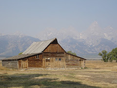
Here are a couple of our snapshots of the area. Professional photos abound online.
I should edit out the pavement and buildings.
Saturday we drove over to Cottonwood, which is adjacent to the
Tuzigoot National Monument, which I think I have mentioned was the site of one of the first trips we made in our first motor home which we subsequently named Tuzigoot. We didn't tour the monument this time, but we got the picture. We also found the nearby campground where we spent a night or two in Tuzigoot1 with Susie's cousin, Jane, and her husband, Dick. And, yes, they had dog named Spot!
There's an extensive set of ruins on that hilltop. I should photoshop a picture of Tuzigoot2, the motor home, into that picture.
In the "Old Cottonwood" part of Cottonwood, which still bears resemblance to the frontier town it was, we had spotted a BBQ joint on the drive in, so we decided to stop there for dinner on the way back to Camp Verde. It's the Hog Wild BBQ café and quite good. We had dinner and took home food for subsequent meals. Remember that place, so if ....
Easter Sunday
In Sedona we saw a Methodist Church and made plans to go there for our Easter service. But, because of their early start time and the time required to drive there, and unknown traffic, we thought we should check for Camp Verde churches. On-line we found a listing for the
Camp Verde Community Church, a Methodist church, with a 10 am service. Google street-view showed us a picture of the back of a bunch of shops that didn't look very churchy. They turned out to be across the street from the church. We drove to the church address on Saturday and found the nice little church displayed at the above website. We returned Sunday for what turned out to be one of the most memorable Easter services either of us had attended.
It began with a drama - three women playing/miming roles of women who were present at Jesus' crucifixion and resurrection, while a narrator read the corresponding scripture. It gave you the feeling of being there, not just hearing about it.
Pastor Rick preached a very moving, personable, and even dramatic sermon about why Easter is important and what belief in the resurrection had meant through history and means now. I wish I had taken notes.
After church we went back to Cottonwood to find a lunch place. I thought Old Cottonwood might have something, but it was pretty well shut down on a Sunday. Susie had spotted a hoppin' place in Cottonwood, so we drove back and found
Georgie's Cafe. It looked like the go-to place for weekend breakfasts and lunches. (Yelp scores it as 4.5/5 stars.) It has something of a Greek emphasis, but much more. I had a beef gyro and Susie had meatloaf. Very good, so the next time you're in the Cottonwood, AZ area, check it out.
Sunday afternoon I went to the
Montezuma Castle and Montezuma Well National Monument, both just a few miles north of Camp Verde.
The Sinagua people built what was a five-story, 20-room dwelling, 100 ft. above the valley floor, between 1100 and 1300. When Teddy Roosevelt and Congress created the national monument program, this was one of the first four so designated. Montezuma was never here, presumably, but the first American settlers in the area thought the structure was Aztec-built; hence the name.
A year-round stream flows through the valley, so farming was good. But the people moved to Sedona and were never seen again.
Nearby Montezuma Well flowed into the stream. This "well" is a "limestone sink." Spring water flowing through a limestone hill hollowed it out and the ceiling eventually collapsed, creating a remarkable pool of water in the middle of a desert. Underground springs feed this pool at a rate of 1.6 million gallons per day and the outflow feeds the stream that flows by the Castle. The pool is about 400 ft. across. Divers have found leeches in the bottom of this pond like none ever seen elsewhere. Now, explain that (brought here by aliens from another planet?).
Homeward Bound
Earlier we had planned to spend a few days at a campground in Overgaard, in eastern AZ. We stayed there several years ago and even planned an RV rally for there that didn't happen for lack of interest and bad timing. But they don't open until April 1 and it was still March. Nevertheless we took a route home via Overgaard just to see the area and to minimize our time on I-40.
Our route, as we left Camp Verde on Monday, 3/28, was AZ 260 east to Show Low, then north to Holbrook and I-40, etc. Thus we followed the route to Payson that Roger and I had ridden in 1987. I saw a few memorial signs along the road, but didn't (couldn't) stop and see if one pertained to the death of our co-rider. In fact, the route is mountainous and the road narrow and the wind was blowing like crazy, so it was keep your eyes on the road and don't try to change the radio station or read the roadside signs. I try to watch for opportunities to pull over and let people by, when traffic collects behind me, but sometimes by the time you see the potential pullover there is not time to stop. So, you watch for the next opportunity. Rte. 260, though, has fairly frequent well-marked passing lanes that help prevent traffic backup.
East of Payson, much of the road is four-laned. It takes you up the Mogollon Rim. There's a nice viewing and picnicking area as you reach the top. A very cold wind of near-hurricane force meant that only I got out for a quick picture.
I was going to take a video so you could hear the wind, but conditions were miserable and I couldn't see my iPhone buttons.
Around lunchtime we drove through Overgaard, but didn't find much open or accessible there, so we pressed on another hour to Show Low. Weren't finding many lunch opportunities (though we could have stopped in a grocery store parking lot and eaten some of our remaining food supply - but that's not our style). Just as we were about to leave town, one more hour to Holbrook, we spotted the
Jalapeno Café, on the north side of town. It had a large dirt parking lot, which must mean it's frequented by truck drivers, so you know it has to be good, right? It features loaded tacos and quesadillas and much more. It's the Subway model and then some. You tell them what ingredients and - this is beyond Subway - how much of them to load on to your taco shells or quesadilla tortillas and they load and cook them. You can choose among various salsas, meats, beans (refried, pinto, or black, e.g.), rices, and vegetables. Of course, chile: red, green, or both. Awesome! Here's a picture from their website of a loaded quesadilla. I got a quesadilla, but not loaded to that extreme. Susie had tacos. Both dishes very tasty. You may want to go to Show Low some time just to dine at the Jalapeno Café. Stay a week.

We could have come all the way home, but decided not to push it, especially with the high winds. We stopped for the night at a large RV park on the west side of Gallup. Wind howled all night and continued the next morning as we drove to Albuquerque. We stopped for diesel fuel at a new Love's travel center west of Albuquerque, where son, Jeff Hinkle, is in training to become a Love's manager at a place TBD (This just in: it's Santa Rosa, NM). We changed our home-return routine in that we parked Tuzi in our storage lot in town, loaded most of our food, clothes, and stuff into the pick-up and drove that on home. Thus, we avoided the hassle of disconnecting, reconnecting and getting in and out of our driveway. Worked well. Live and learn.
In conclusion (at last, you may be saying if you've made it this far) it was a nice, mostly relaxing, entertaining, and interesting three-week trip. Glad to be home. We'll be in touch.
Susie and Rob