About 40 miles before I-84 intersected I-81, in a rural area, I noticed "mileage" markers every tenth of a mile (just stayin' alert). I can understand the utility of one-tenth-mileage markers in congested areas. If there's a breakdown or accident, emergency vehicles can be given a more precise location than the nearest mile, if anybody involved happen to remember it. But, what bureaucratic genius, or Congressperson, decided these signs would be a good expenditure of taxpayer money out in rural Pennsylvania? How much did it cost? Estimates invited. Is the traveling public safer and significantly better informed by never being more than 88 yards from a tenth-mileage marker? Does it help to be able to let a contract for repair between mile markers 40.3 and 67.7? Or assign a trash-pickup crew with great precision? It's an outrage! "Lighten up, Rob," says Susie!
Then I noticed that at 60 mph the time between tenth-mile markers was just right for one verse of 99 Bottles of Beer on the Wall, ... . So, that's one way to make the time go by. Every 10 miles you can sing all 100 verses. Then, I thought up new words: Starting at milepost 40.
400 mile markers on the road, 400 markers to go. Pass one by and then you've got, 399 mile markers to go. Etcetera, etcetera, ... .
I hope I've transferred that ditty from my subconscious to yours. Susie says, "If Rob would engage in a conversation, he wouldn't have to entertain himself with such trivia. Rob replies: I have nothing to say.
From our KOA guide we chose a KOA in Jonestown for a stopping place. (If it wasn't for KOAs and Cracker Barrels, we'd be lost out here.) The guide said take Exit 90 and follow the signs. The campground address was listed as Old Route 22 but Miss GPS didn't recognize that street, so I couldn't program it in. But, it shouldn't be that hard, should it? KOA generally does a great job of signage.
Well, we saw one sign at the exit, but not more. After a while it became apparent we were going the wrong direction, by several miles. Susie:and THIS time it was not my fault! Rob: Never entered my mind. Stopped at a convenience store; the clerk had no idea about a KOA or where Old 22 was. I called the park, got directions, was fortunately able to turn around in a truck storage lot behind the convenience store, and worked our way back to the Old 22 intersection we had missed (because there was no sign; actually it had another name at that point, like Main Street). Drove until Old 22 intersected with Current 22, but didn't see the KOA. Susie said, I saw a Jonestown Campground. Maybe that was it. (Rob: Now she tells me.) Executed another u-turn and went slowly back down Old 22. Found the campground entrance, but no KOA sign. Decided this must be it and it was - sort of. The campground had been sold or transferred to new management. The paperwork wasn't complete, however, and they had been required to cover all KOA signs - and I guess all the signs we were supposed to follow had been covered or removed, too. We sort of commiserated over all that with the new management and we signed up for a night's stay. Friendly new folks in charge; we wanted to help them.
We were assigned a space and drove to it. Unfortunately, it was a tent space (looked bigger on the campground map), not an RV pull-thru site. The new management was not yet familiar with their park. One of the workers scouted the campground and came back to tell us there were a couple of back-in spots we could try. But it had been a long day and didn't think I wanted the challenge of a back-in site in a heavily wooded, somewhat cramped park. So, we said we'd go on and find another campground.
It was hard getting out of the park. Susie had to get out and guide me between the trees and rocks. En route I saw one vacant slot they probably had in mind for us and was glad we didn't try.
We had just passed another KOA about 10 miles prior to the Jonestown exit, so we worked our way back to it. This was more than a campground; it was a resort with campground attached. There was a small Ferris wheel, an enclosed carousel, a frisbee golf course, and other family fun things. Main thing was they had a space available and it was easy to get into.
Monday dawned rainy and we did laundry and I worked some on my notes for the upcoming class I'm teaching at Sandia starting in November. We decided to spend a second night. When I called the office, the receptionist said, We may have a problem. That area is scheduled for repaving tomorrow. You may need to move to another site. I said, If we're away by 8am, would that be soon enough? They said OK. A few miles down the road the next morning we met paving equipment heading toward the park.
Our Tuesday objective was Cumberland, MD, where we would visit friend, Brian Wall. Brian used to manage a shopping mall in Albq, now he manages one in Cumberland. His wife, Josefa, is still in Albq trying to sell their house there and simultaneously find a job in Cumberland. Cumberland is a historic town in a beautiful area, and fall foliage was in prime condition, so we had thought we might spend two nights there and tour the area. Unfortunately, there are no RV parks in or near Cumberland. Not enough flat land, I think.
Here are some fall pictures of Cumberland from the internet
We met Brian at the mall. He gave us a driving tour of nearby Frostburg, where he is living, and downtown Cumberland, where we went for lunch.
Cumberland is known for its church spires - a nice collection. Here is a church that has three stained-glass windows personally crafted by Louis Comfort Tiffany himself.

Here's Brian (bad sun angle, my bad, but I wanted Mall entrance in background) and a shot of the hillside across from the mall's parking lot.


This was Tuesday and we really wanted to have TV that night for Dancing With Stars and the Romney-Obama debate. We drove toward Morgantown, WV. (Nice foliage along the way, by the way.) Only one RV park was listed near there. They didn't have cable service, but said you could get local channels via an antenna. So, we drove up a few miles up a narrow mountain road to this campground. In the parking lot w checked TV reception. Couldn't get a thing (realized a day later that I hadn't worked the digital converter correctly - one more senior moment, you might say). So, we switched to plan B - a motel.
This picture, copied from a WV internet site, is sort of like the road in to the campground.

Before this side trip, at the WV Welcome Center, already thinking motel, I had picked up some flyers. We picked an Econolodge that advertized truck and bus parking and found our way there. That worked just fine. In addition to TV, Susie particularly appreciated the luxury of a bathtub.
By this time I had formed a strategy for our homeward trip: follow US 50. Years ago, it might have been 1976, there was a Time magazine special issue focused on "America's Main Street: US 50." For some reason I remember that. A few years ago I went so far as to get a AAA Route 50 guide, just in case, but I didn't bring that with us. (Some of you may remember a Route 60 trek in Tuzigoot I several years ago. So many highways, so little time.) A short drive south of Morgantown we picked up US 50 at Clarksburg and headed west. We'll pick up the tale tomorrow.
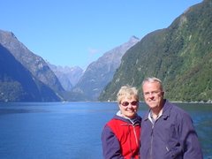
Rob and Susie


No comments:
Post a Comment