Friday, April 23, 2010

Lexington Gardens


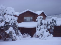
I went out Sunday morning, as I did several mornings in Frankfort, driving around the countryside looking for Canon Moments.  Here's a nice Kentucky Home.


Some nice Kentucky Horses:


And a nice Kentucky Barn.


On Sunday we attended the First Methodist Church in Frankfort - a nice, old church in downtown Frankfort. 


The church is leading an effort, called Go Frankfort, to improve life in Frankfort -- building playgrounds, cleaning up vacant property, painting a RR overpass, etc., and we heard an enthusiastic presentation about this year's projects.

Then, looking for more spring flowers, dogwoods and redbuds, we went over to Lexington, about 25 miles east of Frankfort.  Drove US 60 over, admiring the farms, then found our way to the UK Arboretum.


Next, Ashland, the home of Henry Clay


The Clay garden was mostly greenery, not flowery, so no nice flowering trees to show here.  Instead, here, from Wikipedia, is a picture of the man himself.


While I looked around the grounds, Susie texted the kids and also Joyce and Jay Rush, with whom we had crossed paths in NM and Las Vegas several times in Feb. and March.  From NM Jay and Joyce had gone to Tahlequah, OK for a Habitat for Humanity project.  We had talked on the phone, but we didn't connect with them in OK as we swept across the state, Kentucky-bound.  Well, Joyce called Susie and said, Where are you?  Lo and behold, J&J were also in Lexington!  Only a mile or so from Ashland.  Their son, Michael, and family live in Lexington.  They're in the process of moving to NE TN so we hadn't even thought about them possibly being in Lexington, much less about the possibility that J&J were in town.  We went over and had a nice visit. 

Two more days in Frankfort.  Monday we're going to Danville, Tuesday back to Lexington to take a horse farm tour.  Wednesday we move north to Cincinnati and get ready for a weekend of soccer.

Cheers,

Susie and Rob

Thursday, April 22, 2010

Chocolate Festival - Washington

In one burst of advanced planning before we left NM I searched the internet for Kentucky Fairs and Festivals for the weekend of April 17, 18.  I thought there would be many to choose from.  I found two: a hillbilly festival in far SE KY and a Chocolate Festival in NE KY at a town called Washington.  The latter was the closer to Frankfort, only about 85 miles away, so that's where we headed on Saturday, 4/17.

Washington, KY is a nicely preserved colonial-era town, one of the first in Kentucky territory, situated about 50 miles SE of Cincinnati a short distance from the Ohio River.  I don't know that the town is particularly linked to chocolate, but that seems as good a reason as any to set up food and craft booths and attract a crowd to check out the town's antique and gift shops. 

Entertainment was provided by an Elvis impersonator, who led off with Kentucky Rain.  Here's the King:


Susie insisted on a picture of me in front of this sign.


The proprietor of this booth was quite a character, keeping up a running commentary on Elvis and the passing scene.  Here, he is telling Susie, "No pictures, please."


A couple of historic buildings:


The sign says the lady for whom this house was built accused her husband of asking her to live in a jail.  He stuccoed it over, but it was later restored to its original look.


Of further historic interest is a Harriet Beecher Stowe Slavery to Freedom Museum.  Stowe, who lived in Cincinnati, as a young woman came to visit a college classmate in Washington.  While there she saw a slave auction, a scene she memorably incorporated into Uncle Tom's Cabin some 20 years later.  Here's a poster from the time.


The family home she visited is now the Museum.

Returning to Frankfort we looped along the Ohio for a few miles.  Here's an attractive bridge.


And the requisite county courthouse.


Cheers,

Susie and Rob

Tuesday, April 20, 2010

Frankfort

Friday we traveled 120 or so miles NE from Cave City to Frankfort.  Took the backroads mostly and made a couple of historical stops.

Abraham Lincoln's birthplace is near Hodgenville.  The memorial there was the first built for him and is at the site of the family cabin.  The memorial is closed for renovation now, girded by construction barriers, so we couldn't go in or get a good exterior shot.  This is a website picture.  Hmm, style seems familiar.


Next we stopped in Bardstown at the My Old Kentucky Home State Park.  This house, the centerpiece of a plantation called Federal Hill, was the family home of the politically prominent Rowan family. 


Stephen Foster, a Pittsburgh boy (that was a surprise - I just assumed he was from the South, but he actually spent very little time there), was a cousin and it is said that his visit here inspired the song.  Wikipedia says some unavoidable skeptical scholars think otherwise. 


We have a nephew named Stephen Collins who is very musically talented, so maybe there's a connection namewise.  I thought it was interesting that the guides emphasized the full name in discussing Foster.

We've seen a lot of houses that would qualify as Old Kentucky Homes.  Here are some.


We got to the Elkhorn Campground in Frankfort in mid-afternoon.  We'll be here five days before moving on to the Cincinnati area for a soccer tournament that grandson Andrew is playing in.  We stayed at the Elkhorn six years ago when we were following US60 westward.  It's a nice park and we're looking forward to some leisurely exploring of the region.

The campground is adjacent to the Elkhorn River.  Here are a couple of pictures - on further reflection.


On Saturday we're off to Washington, KY for a Chocolate Festival -- sweet!

Cheers,

Susie and Rob

Mammoth Cave

Next on our Kentucky agenda, after the Land Between the Lakes, was Mammoth Cave National Park, a drive of about 150 miles from Prizer Point on Lake Barclay; we arrived in early afternoon.  En route we happened upon a Cracker Barrel at lunch time -- Wednesday being a particularly good time for that stop: Susie's favorite - chicken pot pie.  That evening, continuing our Mexi-tucky culinary theme, we had dinner at a Mexican grill near the RV park, and the meal turned out to be quite tasty.  Owner from Acapulco region, so several seafood items on the menu -- I had shrimp in a very good "ranchero" sauce.  However, I'm going to need me some catfish pretty soon.

Thursday I headed into the Park to take a tour (Susie doesn't do caves).  Happened upon this little cemetery in the Park with an interesting name: Abandon hope all ye who enter here?


There are several tours you can take: I opted for the Grand Avenue tour.  This is a 4-mile, 4.5 hr. "Long Walk Through a Whole Lot of Rock," as our guide dubbed it.  Mammoth Cave is the longest known cave system in the world with nearly 400 miles of discovered passageways. (Second place is Jewel Cave in SD with 150 miles.)  A passageway is defined as an opening large enough for a human (of reasonable size) to squeeze, crawl, or slither through it.  There are five levels, vertically, of these passageways.  There is another tour available caled the Wild Cave tour.  It covers five miles in 6.5 hrs. and includes a lot of these tight squeezes.  You find your way using helmet lamps, not lighted passageways.

We started with the Cleaveland Avenue passageway, a mile or more of a broad canyon, sort of like a subway tunnel filled with a jumble of rocks.  Lunch break was in an underground dining area called the Snowball Room because of these ceiling formations. 


After lunch we went through Boone Avenue. The passageway here was very narrow, often only shoulder wide, but vertically very high. Kind of like walking through the sort of slot canyons you see in Utah, except there is no sky overhead.


The path onward had a lot of ups and downs as the path passed over areas of fallen rock.  We ended up in an area that included the "Frozen Niagra" formation.  A lot of Mammoth Cave is covered by a impervious sandstone layer, so water has not seeped through it and formed the stalagtites and stalagmites you tend to associate with caves.  The Frozen Niagra area, though, has these formations.  Here are a couple of my pictures from here:


And here's an internet picture of Frozen Niagra:

 
The story of how the National Park came into being is interesting, as Ranger Rick told us.  In the 1930s different individuals owned separate parts of Mammoth Cave.  Also, there are other caves in the region.  Fierce competition broke out in what became known as the Kentucky Cave War.  Confusing signs were posted: This way to official entrance to Mammoth Cave. This way to shortest route to MC.  (The isgns are still there - confused us on our first drive to the Park.  Now the signs are trying to get you to drive past various roadside attractions along the way.)  Tourists would be intercepted by guys wearing ranger-like uniforms who would direct them to their employer's cave.  Or, tell them that there was an outbreak of some disease like bat fever, so the cave you want to visit is quarantined.  There was also vandalism against the competition's caves.  The good people of KY decided to put a stop to this and to work to establish a National Park that would include all of Mammoth Cave.  The US government couldn't buy up the land, so KY raised money by donations, during the Depression, to buy the land where they could, including the use of eminent domain to force some sales (Wikipedia says there is still lingering bad feelings about that) and put it all together.  The National Park was dedicated in 1941.  There is no fee to drive into the park.  The tours are fee events. 

I considered going back for a shorter tour on Friday, but my feet were still feeling the four-mile after-effects, so I drove the countryside looking for barn pictures.  KY has a lot of barns like this, plain rectangles, unpainted, or black.

Here's a more traditional style:


I liked the flared-out lines of this one:


Some farmland to admire:


In fact, there's a lot of farmland to admire.  We've really been enjoying the pastures, fences, big farmhouses, etc.  Next we're heading for Frankfort and the nearby Lexington horse country.

Until then,

Cheers,

Susie and Rob

Saturday, April 17, 2010

The Land Between The Lakes

Monday morning we drove all of 40 miles to our next RV park, a KOA at Prizer Point on Lake Barkley.  We had planned to spend only one night there, but it was such a pleasant location that we immediately decided on two nights. 


Monday p.m. we just relaxed. Tuesday we visited the Land Between the Lakes National Recreation Area with a side trip to Murray, KY.


On the way to LBL (as it's abbreviated) we stopped in Cadiz, KY, birthplace of Elizabeth Anthony (whose husband, Allen, you met in our Kentucky Bend posting).  Cadiz is pronounced K.D.'s, as in something belonging to Miss Lang.  We strolled through some antique shops in this scenic town and had lunch.
 
The big annual event in Cadiz is a fall Hog Festival.  You can buy a t-shirt advertizing the (fictional) Ham Hock Cafe.  They've expanded the hog theme to painted pig statues all through town.  That may be a Hog parked in front of those two pigs, too.
 

Two parallel rivers, the Tennessee and the Cumberland, run north through TN and KY and empty into the Ohio River.  The "land between the rivers" became the Land Between the Lakes when both rivers were dammed to provide hydroelectric power, flood prevention, and shipping along the TN River.  Then, in 1963 President Kennedy declared the LBL region to be a National Recreation Area.  This meant that the farmers and other residents had to be relocated.  The Wikipedia LBL site indicates that not everyone was happy about that.  It wasn't like their land was going to be covered by a lake.  The government just wanted to use the land for other purposes.

The main visitor center is at Golden Pond, site of a former town.  Just behind the dogwood you can glimpse the pond.


At one of the visitor centers I was looking at a detailed LBL map and noticed a lot of cemeteries.  Driving through the LBL we had seen several side-roads going to cemeteries.  I asked how many cemeteries?  About 270.  Around 5000 families were moved; their homes and a few small villages were razed.  There is still farming, though, in cleared areas.  The cemeteries are the lone connection of residents and descendants to the land of their families.  Now there are buffalo and elk and other wildlife, lots of hiking trails, a few campgrounds, and a recreated 1850s homestead.   Here are some scenes from "The Homeplace."


This gentleman is preparing to plant cotton.


This shapely scarecrow is scaring the crows away from the garden.


Here's another pond scene we came across.


After LBL we drove about 20 miles SW to the town of Murray.  This is the home town of friend, Pat Young, formerly Cedar Crest, now of Bastrop, TX.  We talked to her earlier in the week and she encouraged us to see Murray.  We took a turn by the Murray State U campus.


Then, found our way down town for the traditional county courthouse picture.


On the way down town, though, Susie said, "There's a Mexican restaurant.  Let's go have a chips and salsa snack."  (It was mid-afternoon.)  We did, and it was good.  We've been gone just over a week.  Could we/Susie be having salsa-withdrawal symptoms already?  A few blocks later, we found an ice cream place.  What a day!

Back at Prizer Point, caught the sunset.  We had seen signs that the LBL rangers were doing controlled burns and in fact had to reverse our course once when we found a road closed in a fire area.  The ashes in the sky helped add color to the sunset. 


Next stop: Mammoth Cave.

Cheers,

Susie and Rob

Wednesday, April 14, 2010

New Madrid and More

We generally associate U.S. earthquakes with California, so it may not be widely known that one of the largest (lower 48 states) U.S. earthquakes occurred in New Madrid, in the bootheel of what became MO, in 1812.  I learned about this earthquake several years ago in conjunction with the issue of estimating the risk of earthquakes to nuclear power plants.  After our visit to the KY Bubbleland, we decided to go take a look at New Madrid. 


Getting there gave us the opportunity to cross the Mississippi via the Dorena-Hickman Ferry.  We had considered taking Tuzigoot across the day before, going East, but decided against it.  Glad we did, because we would surely have scraped getting on and off.  This picture is from the Ferry website.


We got to the dock just as the ferry was pulling away, so that gave us some time to enjoy the show.  Two guys in a pickup, carrying a small boat, soon pulled up.  They lived in MO, had been fishing in TN this fine day.  They showed us a cooler full of crappie.  Also told us that the ferry landing had been under water until just a few days earlier.  Then a van pulling a utility trailer pulled up; six guys got out.  Sounded like their GPS had just led them there and they weren't sure they were where they wanted to be.  They asked, Can you get to Cape Girardeau this way?  Susie found out later that they were a band from Jefferson City, MO, returning from playing in Nashville.  Last to arrive was a group of 15-20 motorcycles, drivers and riders.  Out for a Sunday outing.  The ferry filled up.  Here's a picture:


An old motorhome, pulling a boat, is about to squeeze on in this picture. 

One of the band members took this shot of us:


Not a lot to see in New Madrid, but there is a museum with info about the earthquake and the Civil War battle.  One fact that stands out: New Madrid sank about 15 ft. as a result of the earthquake.  Also, very large earthquakes occurred repeatedly over a two-month period, as the above sign says. 

Saw this in Hickman , KY.


Also came across this county courthouse somewhere along the way:


On the way back to KY from New Madrid, Susie had me stop to take this picture in recognition of one of her friends:


"So that's where she gets them," she said.

Several people (at least two) had told us we should see Columbus-Belmont State Park.  This is a site on the KY shore of the Mississippi where the Confederates again tried to prevent the Union Army from moving south on the river.  So, once we did the MO-IL-KY hop, skip, and a jump across two bridges on US 60 again, we worked our way down to this state park.    From the KY bluffs overlooking the river it looked like a good place for the Confederates to blockade the river, but it didn't work long.  Makes for a nice park, though.


Got home after about an 11-hour, four-state outing.  An interesting, scenic day.

Cheers,

Susie and Rob