The Missouri originates where three rivers come together in a remarkable confluence. I tried to find a good aerial view but couldn't. If you use Google Earth, go to Three Forks, Montana and take a look from above.
Here’s my riverbank view.

The explorers named these three rivers, from east to west (left to right above), for their leading supporters: the Gallatin (Sec. of Treasury), Madison (Sec. of State), and Jefferson Rivers. In this picture, the Gallatin is coming from the left, the Madison straight at you, just left of center, and the Jefferson from the right.
Apparently there was some discussion of whether they should call the largest branch the continuation of the Missouri, instead of designating it with a different name. I don't know the protocol, but their designation stuck. They went up the Jefferson to where it was created by the confluence of the Beaverhead, Big Hole, and Ruby Rivers, then took the Beaverhead on south. That river runs through the valley in which Dillon is situated.
North of Dillon about 15 miles is this prominent rock that the Indians called Beaver Head. (The guidebook says you have to look at it from one particular angle, from which it looks like a beaver swimming toward you.) It was a common gathering point. The Corps was looking for the Shoshone, Sacajawea’s tribe, needing to buy horses to continue west when they could no longer use boats. At this point, Lewis and a lead party were scouting ahead; Clark was nursing an injury ("a tumer on my anckle musle") and coming behind with the boats.
North of Dillon about 15 miles is this prominent rock that the Indians called Beaver Head. (The guidebook says you have to look at it from one particular angle, from which it looks like a beaver swimming toward you.) It was a common gathering point. The Corps was looking for the Shoshone, Sacajawea’s tribe, needing to buy horses to continue west when they could no longer use boats. At this point, Lewis and a lead party were scouting ahead; Clark was nursing an injury ("a tumer on my anckle musle") and coming behind with the boats.

Here, Sacagawea tells Lewis and Clark, I told you this was the right way.

At the north edge of Dillon is this little promontory called Clark’s Lookout. From this knob, Clark had a good view of the valley. He took compass and sextant readings and sketched a map. Our National Geographic guidebook says this is one place you can be sure you’re standing exactly where Clark stood. That’s cool.

Here’s my re-enactment:

Caption: Where’s Meriwether?
About a mile south of Clark's Lookout the Beaverhead runs by the KOA site. Who knows, maybe Clark and company camped there, too. Nice Kabins available.

After another four days of slogging up the Beaverhead, still looking for Lewis, still needing to trade their boats for horses, the Clark party was 20 miles south of Dillon. There, with some trepidation, they encountered an Indian party. Then they recognized one of Lewis’s party dressed in Indian garb– they had caught up with Lewis.
People gathered. One of the Shoshone women recognized Sacagawea. As she was translating, Sacagawea recognized a Shoshone chief as her brother! (You can't make this stuff up.) Lewis, ranging out ahead, had encountered a Shoshone tribe and convinced them to come back to the Beaverhead valley, bringing horses that the Corps needed desperately to buy. It worked out: guns and ammo for horses.


History says this was one of the most critical points in the expedition. L&C recognized that and named the meeting location, Fortunate Camp.
The Fortunate Camp site is now covered by the Clark Reservoir -- about halfway out to this island.
So, our trip up portions of the Missouri and its tributaries, retracing Lewis and Clark, ends where they finally stashed their boats and headed on west overland. It's been fun and also sobering to focus on what their expedition accomplished. Hope you enjoyed this part of our Tuzi-trip.
Cheers,
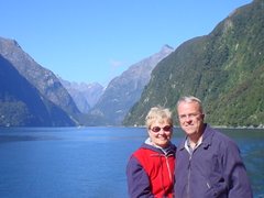
Susie and Rob


No comments:
Post a Comment